Area Overview for B61 7AY
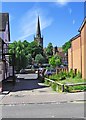
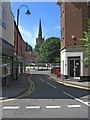
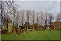
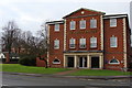
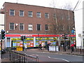
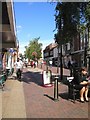
Photos of B61 7AY


Area Information
Living in B61 7AY offers a quiet, residential lifestyle in a small cluster of homes. With a population of 1,668, the area is compact yet well-served by nearby amenities. The community is predominantly composed of adults aged 30–64, reflecting a mature demographic with strong home ownership. Most residents live in houses, a characteristic that suggests a stable, long-term presence. The area’s proximity to Bromsgrove Railway Station and other nearby stations ensures easy access to regional transport networks. For families, the independent Whitford Hall School provides a private education option, though the area’s small size means it is best suited for those prioritising convenience over sprawling urban facilities. Daily life here is defined by low crime risk, with a safety score of 86, and no significant environmental hazards such as flood zones or protected natural areas. The broadband and mobile connectivity scores are high, supporting both remote work and everyday digital needs. B61 7AY is ideal for those seeking a peaceful, low-maintenance environment with practical access to essential services.
- Area Type
- Postcode
- Area Size
- Not available
- Population
- 1668
- Population Density
- 2633 people/km²
The property market in B61 7AY is defined by high home ownership (87%) and a predominance of houses. This suggests a community where long-term residency is the norm, with few rental properties available. The focus on owner-occupied homes indicates a stable market, where properties are likely to appreciate in value due to limited supply and demand from established residents. Given the area’s small size, the housing stock is limited, making it a niche market for buyers seeking a quiet, low-density environment. The presence of nearby rail stations, such as Bromsgrove and Alvechurch, may enhance the area’s appeal for commuters, though the lack of larger urban amenities means it is best suited for those prioritising convenience over proximity to major cities. For prospective buyers, the market offers a mix of traditional homes with strong local ties, though the small footprint means competition for available properties could be keen.
House Prices in B61 7AY
No properties found in this postcode.
Energy Efficiency in B61 7AY
Residents of B61 7AY have access to a range of nearby amenities, including retail outlets such as Waitrose Bromsgrove, Asda Bromsgrove, and Co-op Bromsgrove. These stores provide convenience for everyday shopping, from groceries to household essentials. The area’s rail stations also serve as hubs for commuting and regional travel, connecting residents to broader networks. While the data does not specify parks or leisure facilities, the presence of multiple retail and transport options suggests a lifestyle focused on practicality and accessibility. The small cluster of homes means that amenities are within practical reach, reducing the need for long commutes. For those valuing a balance between convenience and tranquillity, B61 7AY offers a compact yet functional environment, with services and transport links that support both daily needs and occasional excursions.
Amenities
Schools
The nearest school to B61 7AY is Whitford Hall School, an independent institution. This type of school typically offers fee-based education with a focus on academic and extracurricular excellence. While the data does not include an Ofsted rating, the presence of an independent school suggests the area may attract families seeking private education options. However, the limited number of schools in the vicinity means that families may need to travel further for alternative educational choices, such as state schools. The absence of other schools in the immediate area indicates a reliance on nearby towns for broader educational provision. For those prioritising independent schooling, Whitford Hall School is a key feature, but it is important to consider the broader regional school landscape when evaluating the area’s suitability for families.
| Rank | School | Type | Entry gender | Ages |
|---|
Explore more schools in this area
Go to Schools tabDemographics
The residents of B61 7AY are predominantly adults aged 30–64, with a median age of 47. This suggests a community of established professionals and families, many of whom have lived in the area for years. Home ownership is exceptionally high at 87%, indicating a strong sense of stability and long-term investment in property. The accommodation type is primarily houses, which aligns with the area’s residential character and the absence of high-density housing. The predominant ethnic group is White, reflecting a homogenous demographic profile. While this data does not provide specific information on deprivation levels, the high home ownership and mature age range suggest a community with relatively consistent access to resources and services. The low crime risk further supports a quality of life that prioritises safety and tranquillity. For buyers, this profile indicates a market driven by owner-occupiers rather than renters, with properties likely to retain value over time.
Household Size
Accommodation Type
Tenure
Ethnic Group
Religion
Household Composition
Age
Household Deprivation
NS-SEC
Explore more demographic insights in this area
Go to Demographics tabPlanning
Planning Constraints
- Flood RiskPremium
- Ramsar Wetland SitesPremium
- Area of Outstanding Natural BeautyPremium
- Protected Nature ReservePremium
- Protected WoodlandPremium