Area Overview for B61 7AH
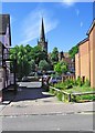
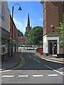
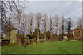
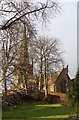
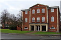
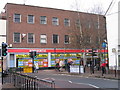
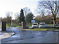
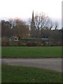
Photos of B61 7AH


Area Information
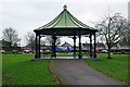
Living in B61 7AH means being part of a small, tightly knit residential cluster in Bromsgrove, Worcestershire. With a population of 2,038, the area is compact but offers a balance of suburban calm and accessible amenities. The community is anchored by Sanders Park, a public space with recreational facilities like tennis courts, a skate park, and a pond, reflecting the area’s focus on family-friendly living. The postcode sits near Bromsgrove Town Centre, blending proximity to urban conveniences with a quieter residential character. The demographic profile—centred on adults aged 30–64—suggests a stable, established community, with homes primarily occupied by owner-occupiers. While the area lacks high-density development, its small size fosters a sense of familiarity, where local landmarks like St John’s CofE Foundation Middle School and Bromsgrove School shape daily life. For those seeking a manageable, low-traffic environment with access to green spaces and nearby transport links, B61 7AH offers a distinct blend of practicality and local charm.
- Area Type
- Postcode
- Area Size
- Not available
- Population
- 2038
- Population Density
- 2538 people/km²
The property market in B61 7AH is characterised by a 52% home ownership rate, suggesting that nearly half of properties are rented, likely through private landlords or social housing. The accommodation type is primarily houses, which are more common than flats or apartments, indicating a semi-detached or terraced housing stock. This mix implies a family-oriented market, with homes suited to those seeking space and privacy. The small size of the area means the housing stock is limited, so buyers may face competition for available properties. The predominance of owner-occupied homes suggests a degree of stability, but the rental market’s presence could influence price trends. For buyers, the compact nature of the area means proximity to amenities is a key advantage, though the limited property selection may require flexibility in location or property type.
House Prices in B61 7AH
No properties found in this postcode.
Energy Efficiency in B61 7AH
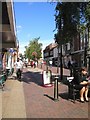
Residents of B61 7AH have access to a range of amenities within practical reach, including retail options like Waitrose Bromsgrove, Asda Bromsgrove, and Spar, which cater to everyday shopping needs. The area’s proximity to Bromsgrove Town Centre ensures a variety of dining and leisure choices, though specific venues are not detailed in the data. Sanders Park is a central feature, offering sports facilities, a skate park, and a pond, fostering community activity and outdoor recreation. The park’s history as a gift from the Sanders family underscores its role as a public asset, enhancing the area’s quality of life. With rail stations nearby and strong digital connectivity, daily life in B61 7AH combines suburban convenience with opportunities for leisure and connectivity.
Amenities
Schools
The schools near B61 7AH include St John’s CofE Foundation Middle School, a primary school, and Bromsgrove School, an independent institution. Additionally, St John’s Church of England Middle School Academy, an academy with a ‘good’ Ofsted rating, serves the area. This mix of school types offers families a range of educational options, from state-funded primary education to private schooling. The presence of an academy with a strong rating suggests a focus on academic standards and resources, while Bromsgrove School’s independent status may appeal to those seeking alternative curricula or smaller class sizes. The proximity of these schools to residential areas ensures accessibility for local families, though the lack of secondary schools in the immediate vicinity may require commuting.
| Rank | School | Type | Entry gender | Ages |
|---|
Explore more schools in this area
Go to Schools tabDemographics
The population of B61 7AH is 2,038, with a median age of 47, indicating a community skewed towards middle-aged adults. The most common age range is 30–64 years, suggesting a mix of families and long-term residents. Home ownership stands at 52%, slightly below the national average, pointing to a modest rental market alongside owner-occupied properties. The area’s accommodation is predominantly houses, reflecting a semi-rural or suburban layout rather than high-rise or terraced housing. The predominant ethnic group is White, though specific data on diversity is not provided. This demographic profile implies a stable, low-turnover community, where local schools and amenities cater to a consistent population. The absence of detailed deprivation data means quality of life is inferred from infrastructure like broadband connectivity and proximity to services, which appear to meet basic needs.
Household Size
Accommodation Type
Tenure
Ethnic Group
Religion
Household Composition
Age
Household Deprivation
NS-SEC
Explore more demographic insights in this area
Go to Demographics tabPlanning
Planning Constraints
- Flood RiskPremium
- Ramsar Wetland SitesPremium
- Area of Outstanding Natural BeautyPremium
- Protected Nature ReservePremium
- Protected WoodlandPremium