Area Overview for B61 0YZ
Photos of B61 0YZ

Area Information
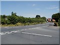
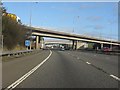
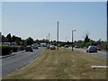
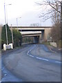
B61 0YZ is a small, tightly knit residential area in Bromsgrove, West Midlands, with a population of 1,747. Its compact size fosters a quiet, community-focused atmosphere, typical of smaller towns in the region. The area’s history is rooted in the broader Bromsgrove district, which historically balanced agriculture with textile and metalworking industries. While Bromsgrove itself avoided the industrial boom of nearby cities like Birmingham, it retains a distinct character shaped by its rural-urban blend. Residents here benefit from proximity to rail networks, with five stations within practical reach, including Bromsgrove and Barnt Green. The area’s low crime risk and flood safety make it an appealing choice for those prioritising security. Daily life is characterised by a mix of local retail, including Sainsburys and Asda, and easy access to transport links, supporting both commuter and semi-rural lifestyles.
- Area Type
- Postcode
- Area Size
- Not available
- Population
- 1747
- Population Density
- 6332 people/km²
B61 0YZ is predominantly an owner-occupied area, with 85% of homes owned by residents rather than rented. The accommodation type is primarily houses, which is typical for smaller, residential postcodes in the West Midlands. This suggests a housing stock that is largely traditional, with limited high-density development. The small size of the area means property choices are constrained, but the high ownership rate indicates a stable market with long-term residents. Buyers should consider that rental options are scarce, and the focus on owner-occupation may mean fewer short-term lettings. The predominance of houses also implies larger properties, which could appeal to families or those seeking more space than typical urban flats.
House Prices in B61 0YZ
No properties found in this postcode.
Energy Efficiency in B61 0YZ
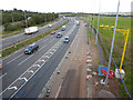
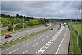
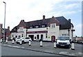
Daily life in B61 0YZ is shaped by its proximity to retail and transport hubs. The area’s nearest shops include Sainsburys Bromsgrove, Asda The, and Spar, offering essential groceries and convenience services. Rail connectivity is a key feature, with five stations—Bromsgrove, Barnt Green, and Alvechurch among them—providing regular services to nearby towns. While the data does not mention parks or leisure facilities, the presence of multiple retail and transport options suggests a practical, service-oriented lifestyle. The area’s small size means amenities are concentrated, making it easy for residents to access shopping, dining, and transport without long journeys. This compactness supports a low-maintenance, community-focused way of life.
Amenities
Schools
| Rank | School | Type | Entry gender | Ages |
|---|
Explore more schools in this area
Go to Schools tabDemographics
The population of B61 0YZ is 1,747, with a median age of 47, indicating a mature demographic skewed towards adults aged 30–64. Home ownership is high at 85%, reflecting a stable, long-term resident base. The area is predominantly occupied by White residents, with housing stock largely comprising detached or semi-detached homes. This profile suggests a community of established families and professionals, less reliant on rental markets. The absence of specific deprivation data means no direct insights into economic challenges, but the high ownership rate implies financial stability. The age range also suggests a lower proportion of younger households or students, which may influence local amenities and services.
Household Size
Accommodation Type
Tenure
Ethnic Group
Religion
Household Composition
Age
Household Deprivation
NS-SEC
Explore more demographic insights in this area
Go to Demographics tabPlanning
Planning Constraints
- Flood RiskPremium
- Ramsar Wetland SitesPremium
- Area of Outstanding Natural BeautyPremium
- Protected Nature ReservePremium
- Protected WoodlandPremium