Area Overview for B61 0QL
Photos of B61 0QL
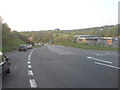


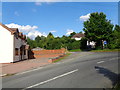
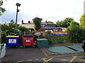
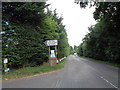
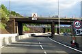

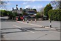

52 photos from this area
Area Information
Key information about the B61 0QL including its size, population, and administrative classification.
- Area Type
- Postcode
- Area Size
- 11.0 hectares
- Population
- 1397
- Population Density
- 2006 people/km²
House Prices in B61 0QL
22
Properties
£306,573
Average Sold Price
£70,000
Lowest Price
£623,000
Highest Price
Showing 22 properties
| Address | Type | Beds | Baths | Last Sale Price | Last Sale Date | |
|---|---|---|---|---|---|---|
| 55 Halesowen Road, Lydiate Ash, B61 0QL | Semi-detached | 4 | 4 | £205,000 | Dec 2022 | |
| 33 Halesowen Road, Lydiate Ash, B61 0QL | house | 4 | - | £397,000 | Apr 2022 | |
| 49 Halesowen Road, Lydiate Ash, B61 0QL | house | - | - | £265,000 | Oct 2020 | |
| The Croft, Halesowen Road, Lydiate Ash, B61 0QL | Semi-detached | 4 | 4 | £623,000 | Sep 2020 | |
| 45 Halesowen Road, Lydiate Ash, B61 0QL | Semi-detached | 3 | 1 | £299,950 | Dec 2019 | |
| 47 Halesowen Road, Lydiate Ash, B61 0QL | house | - | - | £315,000 | Oct 2016 | |
| 39 Halesowen Road, Lydiate Ash, B61 0QL | house | - | - | £288,000 | Apr 2016 | |
| Lydiate Ash House, 61 Halesowen Road, Lydiate Ash, B61 0QL | Detached | 7 | - | £612,500 | Sep 2015 | |
| 43 Halesowen Road, Lydiate Ash, B61 0QL | Semi-detached | 3 | 1 | £265,000 | Jul 2015 | |
| 57 Halesowen Road, Lydiate Ash, B61 0QL | Semi-detached | 3 | 2 | £190,000 | Sep 2009 |
Page 1 of 3
Energy Efficiency in B61 0QL
Amenities
Schools
| Rank | School | Type | Entry gender | Ages |
|---|
Explore more schools in this area
Go to Schools tabDemographics
Household Size
Family (3-5 people)
most common
Accommodation Type
Houses
most common
Tenure
63
majority
Ethnic Group
White
most common
Religion
N/A
most common
Household Composition
N/A
most common
Age
47
median
Adults (30-64 years)
most common
Household Deprivation
N/A
with no deprivation
NS-SEC
35
in Lower managerial occupations
Explore more demographic insights in this area
Go to Demographics tabPlanning
Planning Constraints
- Flood RiskPremium
- Ramsar Wetland SitesPremium
- Area of Outstanding Natural BeautyPremium
- Protected Nature ReservePremium
- Protected WoodlandPremium