Area Overview for B61 0QD
Photos of B61 0QD


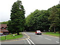
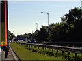
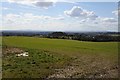

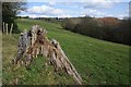
44 photos from this area
Area Information
Key information about the B61 0QD including its size, population, and administrative classification.
- Area Type
- Postcode
- Area Size
- 19.2 hectares
- Population
- 2062
- Population Density
- 951 people/km²
House Prices in B61 0QD
6
Properties
£418,000
Average Sold Price
£180,000
Lowest Price
£624,000
Highest Price
Showing 6 properties
| Address | Type | Beds | Baths | Last Sale Price | Last Sale Date | |
|---|---|---|---|---|---|---|
| 665 Birmingham Road, Marlbrook, B61 0QD | Semi-detached | 2 | 1 | £450,000 | Nov 2023 | |
| 658 Birmingham Road, Marlbrook, B61 0QD | house | - | - | £624,000 | Mar 2021 | |
| 668 Birmingham Road, Marlbrook, B61 0QD | Bungalow | 3 | 1 | £180,000 | Dec 2013 | |
| Rowans Wee Chef, Mobile Cafe, Layby Southbound, Birmingham Road, Rubery, B61 0QD | Restaurant | - | - | - | - | |
| 664 Birmingham Road, Marlbrook, B61 0QD | Detached | - | - | - | - | |
| The Meadows Nursing Home, 656 Birmingham Road, Marlbrook, B61 0QD | hospital_care_home | - | - | - | - |
Energy Efficiency in B61 0QD
Amenities
Schools
| Rank | School | Type | Entry gender | Ages |
|---|
Explore more schools in this area
Go to Schools tabDemographics
Household Size
Two person
most common
Accommodation Type
Houses
most common
Tenure
87
majority
Ethnic Group
White
most common
Religion
N/A
most common
Household Composition
N/A
most common
Age
47
median
Adults (30-64 years)
most common
Household Deprivation
N/A
with no deprivation
NS-SEC
36
in Lower managerial occupations
Explore more demographic insights in this area
Go to Demographics tabPlanning
Planning Constraints
- Flood RiskPremium
- Ramsar Wetland SitesPremium
- Area of Outstanding Natural BeautyPremium
- Protected Nature ReservePremium
- Protected WoodlandPremium