Area Overview for B61 0NX
Photos of B61 0NX


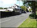
39 photos from this area
Area Information
Key information about the B61 0NX including its size, population, and administrative classification.
- Area Type
- Postcode
- Area Size
- 6268 m²
- Population
- 1745
- Population Density
- 1819 people/km²
House Prices in B61 0NX
28
Properties
£126,808
Average Sold Price
£44,000
Lowest Price
£220,000
Highest Price
Showing 28 properties
| Address | Type | Beds | Baths | Last Sale Price | Last Sale Date | |
|---|---|---|---|---|---|---|
| 23 Bourne Avenue, Catshill, B61 0NX | Terraced | 3 | 1 | £220,000 | Aug 2025 | |
| 19 Bourne Avenue, Catshill, B61 0NX | Terraced | 3 | 1 | £207,500 | Jun 2023 | |
| 21 Bourne Avenue, Catshill, B61 0NX | Retail | 3 | 1 | £210,000 | Nov 2022 | |
| 46 Bourne Avenue, Catshill, B61 0NX | Terraced | 3 | 1 | £188,500 | Apr 2022 | |
| 60 Bourne Avenue, Catshill, B61 0NX | Terraced | 3 | 1 | £180,000 | Jul 2019 | |
| 68 Bourne Avenue, Catshill, B61 0NX | Terraced | 3 | 1 | £168,000 | Mar 2019 | |
| 42 Bourne Avenue, Catshill, B61 0NX | Terraced | 3 | 1 | £180,000 | Mar 2017 | |
| 54 Bourne Avenue, Catshill, B61 0NX | house | 3 | - | £133,000 | Jul 2014 | |
| 64 Bourne Avenue, Catshill, B61 0NX | Terraced | 3 | 1 | £119,000 | Jul 2013 | |
| 40 Bourne Avenue, Catshill, B61 0NX | house | 3 | - | £125,000 | Jun 2012 |
Page 1 of 3
Energy Efficiency in B61 0NX
Amenities
Schools
| Rank | School | Type | Entry gender | Ages |
|---|
Explore more schools in this area
Go to Schools tabDemographics
Household Size
Two person
most common
Accommodation Type
Houses
most common
Tenure
78
majority
Ethnic Group
White
most common
Religion
N/A
most common
Household Composition
N/A
most common
Age
47
median
Adults (30-64 years)
most common
Household Deprivation
N/A
with no deprivation
NS-SEC
36
in Lower managerial occupations
Explore more demographic insights in this area
Go to Demographics tabPlanning
Planning Constraints
- Flood RiskPremium
- Ramsar Wetland SitesPremium
- Area of Outstanding Natural BeautyPremium
- Protected Nature ReservePremium
- Protected WoodlandPremium