Area Overview for B61 0LX
Photos of B61 0LX

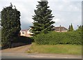
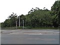

44 photos from this area
Area Information
Key information about the B61 0LX including its size, population, and administrative classification.
- Area Type
- Postcode
- Area Size
- 7215 m²
- Population
- 1375
- Population Density
- 2820 people/km²
House Prices in B61 0LX
18
Properties
£164,939
Average Sold Price
£55,000
Lowest Price
£280,000
Highest Price
Showing 18 properties
| Address | Type | Beds | Baths | Last Sale Price | Last Sale Date | |
|---|---|---|---|---|---|---|
| 1B Haynes Close, Catshill, B61 0LX | house | - | - | £220,000 | May 2022 | |
| 1A Haynes Close, Catshill, B61 0LX | house | 3 | 1 | £187,500 | May 2019 | |
| 5 Haynes Close, Catshill, B61 0LX | house | 3 | - | £164,000 | Mar 2019 | |
| The Firs, Haynes Close, Catshill, B61 0LX | Bungalow | 3 | 1 | £230,000 | Sep 2016 | |
| 4 Haynes Close, Catshill, B61 0LX | Semi-detached | 3 | 2 | £230,000 | Aug 2016 | |
| 2 Haynes Close, Catshill, B61 0LX | Detached | 3 | 1 | £280,000 | Jul 2014 | |
| 1 Haynes Close, Catshill, B61 0LX | Terraced | 3 | - | £58,000 | Jan 1998 | |
| 14 Haynes Close, Catshill, B61 0LX | Semi-detached | - | - | £59,950 | Jun 1997 | |
| 7 Haynes Close, Catshill, B61 0LX | Semi-detached | - | - | £55,000 | Sep 1995 | |
| The Croft, Haynes Close, Catshill, B61 0LX | Bungalow | 1 | 1 | - | - |
Page 1 of 2
Energy Efficiency in B61 0LX
Amenities
Schools
| Rank | School | Type | Entry gender | Ages |
|---|
Explore more schools in this area
Go to Schools tabDemographics
Household Size
One person
most common
Accommodation Type
Houses
most common
Tenure
61
majority
Ethnic Group
White
most common
Religion
N/A
most common
Household Composition
N/A
most common
Age
47
median
Adults (30-64 years)
most common
Household Deprivation
N/A
with no deprivation
NS-SEC
30
in Lower managerial occupations
Explore more demographic insights in this area
Go to Demographics tabPlanning
Planning Constraints
- Flood RiskPremium
- Ramsar Wetland SitesPremium
- Area of Outstanding Natural BeautyPremium
- Protected Nature ReservePremium
- Protected WoodlandPremium