Area Overview for B61 0BB
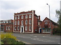
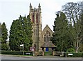
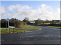
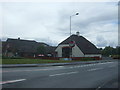
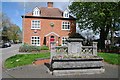
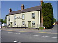
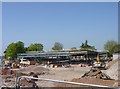
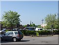
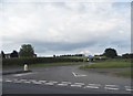
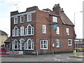
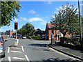
Photos of B61 0BB

Area Information
Living in B61 0BB means residing in a compact, residential postcode area within Bromsgrove, a town in the West Midlands. The area covers 5,422 square metres and is home to 2,254 people, resulting in a dense population of 1,811 residents per square kilometre. This small cluster of homes sits within a historically non-industrialised part of Bromsgrove, which has retained a distinct character compared to larger cities like Birmingham. Daily life here is shaped by its proximity to Bromsgrove’s main services, with residents benefiting from nearby retail and transport links. The area’s compact size means amenities are within practical reach, though its small footprint also means it is not a hub for large-scale commercial or cultural activity. For those seeking a quieter, more residential environment with access to essential services, B61 0BB offers a balance of space and convenience. Its population, predominantly adults aged 30–64, suggests a community focused on stability and family life, with a high proportion of homeowners.
- Area Type
- Postcode
- Area Size
- 5422 m²
- Population
- 2254
- Population Density
- 1811 people/km²
The property market in B61 0BB is largely owner-occupied, with 72% of homes owned by residents rather than rented. This suggests a stable, long-term demographic, with fewer short-term renters or speculative investments. The accommodation type is predominantly houses, which is unusual for a densely populated postcode area but reflects the historical development of Bromsgrove. Houses in this area may be smaller or more compact due to space constraints, yet they dominate over flats or apartments. For buyers, this means the housing stock is likely to be family-friendly, with a focus on private ownership. However, the small size of the area means there is limited scope for new developments, which could affect availability. Prospective buyers should consider the high population density when evaluating property sizes, as this may influence perceptions of space and privacy.
House Prices in B61 0BB
Showing 3 properties
| Address | Type | Beds | Baths | Last Sale Price | Last Sale Date | |
|---|---|---|---|---|---|---|
| Church View House, Princess Of Wales Hospital, Stourbridge Road, Bromsgrove, B61 0BB | commercial | - | - | - | - | |
| New Haven, Prince Of Wales Hospital, Stourbridge Road, Bromsgrove, B61 0BB | commercial | - | - | - | - | |
| Redgrove House, Princess Of Wales Hospital, Stourbridge Road, Bromsgrove, B61 0BB | commercial | - | - | - | - |
Energy Efficiency in B61 0BB
Residents of B61 0BB have access to a range of nearby amenities, including five retail outlets such as Sainsburys Bromsgrove, Iceland Bromsgrove, and Aldi Birmingham. These stores provide essential shopping options for groceries and household items. The area also benefits from five railway stations, including Bromsgrove and Alvechurch, which connect to broader transport networks. While there is no specific mention of parks or leisure facilities in the data, the proximity to Bromsgrove suggests access to local green spaces and community amenities. The compact nature of the area means amenities are within walking or short driving distance, enhancing convenience. However, the absence of detailed information on dining or recreational options means buyers should explore further to understand the full range of lifestyle opportunities available.
Amenities
Schools
The nearest school to B61 0BB is The Mount School, an independent institution. No other schools are listed in the data, so families seeking state education may need to look further afield. The presence of an independent school suggests the area may attract households prioritising private education, though it does not indicate the quality or Ofsted rating of the school. For families relying on state schools, the lack of nearby options could be a consideration. The Mount School’s independent status may also influence the local community’s character, potentially attracting professionals or families who value private schooling. However, without additional data on school performance or accessibility, prospective buyers should conduct further research into educational options beyond the immediate area.
| Rank | School | Type | Entry gender | Ages |
|---|
Explore more schools in this area
Go to Schools tabDemographics
The population of B61 0BB is 2,254, with a median age of 47 and the majority of residents falling within the 30–64 age range. This indicates a community skewed towards middle-aged adults, likely with established careers and families. Home ownership is high, with 72% of properties occupied by owners, suggesting a stable housing market. The accommodation type is predominantly houses, which aligns with the area’s residential character. The predominant ethnic group is White, though no further breakdown of diversity is provided. The population density of 1,811 people per square kilometre is exceptionally high for a UK postcode area, which may influence the feel of the neighbourhood, blending close-knit living with limited space for expansion. This density, combined with the age profile, suggests a mature community with long-term residents, though it also means amenities and services must cater to a concentrated population.
Household Size
Accommodation Type
Tenure
Ethnic Group
Religion
Household Composition
Age
Household Deprivation
NS-SEC
Explore more demographic insights in this area
Go to Demographics tabPlanning
Planning Constraints
- Flood RiskPremium
- Ramsar Wetland SitesPremium
- Area of Outstanding Natural BeautyPremium
- Protected Nature ReservePremium
- Protected WoodlandPremium