Area Overview for B60 9AE
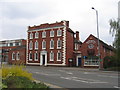
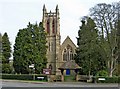
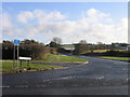
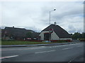
Photos of B60 9AE

Area Information
Living in B60 9AE means being part of a small, defined residential cluster in Bromsgrove, a town in the West Midlands. With a population of 1,667, the area is compact, offering a quiet alternative to larger urban centres. Bromsgrove itself never became a major industrial hub compared to nearby Birmingham or Wolverhampton, which shapes its character as a more subdued, community-focused locale. The area’s demographics suggest a settled population, with a median age of 47 and a majority of residents aged 30–64. This hints at a mix of professionals, families, and long-term residents. Daily life here is likely shaped by proximity to local amenities, including retail outlets and rail links, which connect the area to surrounding towns. The presence of two schools, including a primary and an academy, suggests families are a key part of the community. While the area lacks large-scale infrastructure, its small size fosters a close-knit environment, where residents may know their neighbours and local landmarks. For those seeking a quieter, less sprawling lifestyle, B60 9AE offers a snapshot of traditional English suburbia, with a focus on practical living over urban convenience.
- Area Type
- Postcode
- Area Size
- Not available
- Population
- 1667
- Population Density
- 2809 people/km²
The property market in B60 9AE is defined by a 51% home ownership rate, indicating a balance between owner-occupied and rental properties. Given the area’s small size and the prevalence of flats as the primary accommodation type, the housing stock is likely limited in both quantity and variety. Flats, rather than detached or semi-detached homes, dominate, which may appeal to those seeking affordability or proximity to local services. However, the small scale of the area means the market is not expansive, and buyers should consider the limited availability of properties. The flat-dominated landscape may also suggest a focus on practical living, with less emphasis on larger family homes. For those seeking to buy, the area’s compact nature means competition for properties could be higher, particularly for those prioritising specific locations. The lack of larger housing types may also influence the demographic profile, as flats are often more suited to single occupants or smaller households.
House Prices in B60 9AE
No properties found in this postcode.
Energy Efficiency in B60 9AE
The lifestyle in B60 9AE is shaped by its proximity to retail and rail amenities. Within practical reach, residents have access to five retail outlets, including Iceland Bromsgrove, Lidl Bromsgrove, and Aldi Birmingham. These stores provide everyday shopping convenience, from groceries to household items. Rail stations at Bromsgrove, Barnt Green, and Alvechurch offer connections to surrounding areas, enhancing mobility for commuters or those seeking broader leisure opportunities. While the area lacks detailed information on parks or leisure facilities, the presence of retail and transport options suggests a focus on practicality over expansive recreational spaces. The small population and compact layout mean amenities are likely to be tightly clustered, fostering a sense of convenience for daily needs. However, the absence of specific data on green spaces or cultural venues means the area’s lifestyle is primarily defined by its functional, service-oriented infrastructure.
Amenities
Schools
Residents of B60 9AE have access to two schools named North Bromsgrove High School, one designated as a primary school and the other as an academy. While both share the same name, the distinction between primary and academy suggests a range of educational stages available locally. The presence of a primary school caters to younger children, while the academy likely serves older students, potentially offering specialist or alternative education pathways. This mix may provide families with options depending on their children’s needs, though the absence of additional schools in the data means the area relies heavily on these two institutions. The lack of further educational facilities could be a consideration for parents seeking a broader selection of schools. However, the proximity of both schools to the area implies they are central to local life, potentially influencing the community’s character and daily routines.
| Rank | School | Type | Entry gender | Ages |
|---|
Explore more schools in this area
Go to Schools tabDemographics
The community in B60 9AE is predominantly composed of adults aged 30–64, with a median age of 47. This suggests a population skewed towards middle-aged individuals, many of whom may be established professionals or families in their prime earning years. Home ownership stands at 51%, meaning nearly half of residents own their homes, while the remaining 49% are likely to rent. The accommodation type is primarily flats, which is notable in an area that does not feature high-density housing typical of larger cities. The predominant ethnic group is White, with no specific data provided on other ethnicities. The absence of detailed diversity statistics means the community’s composition is largely homogenous. With a population of just 1,667, the area is small enough that local dynamics are likely to be tightly knit, though this also means limited diversity in social or cultural experiences. The age profile and ownership rates suggest a stable, low-turnover population, which may influence the character of local services and amenities.
Household Size
Accommodation Type
Tenure
Ethnic Group
Religion
Household Composition
Age
Household Deprivation
NS-SEC
Explore more demographic insights in this area
Go to Demographics tabPlanning
Planning Constraints
- Flood RiskPremium
- Ramsar Wetland SitesPremium
- Area of Outstanding Natural BeautyPremium
- Protected Nature ReservePremium
- Protected WoodlandPremium