Area Overview for B60 4NZ
Photos of B60 4NZ
Area Information
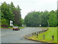
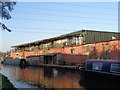
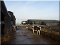
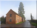
B60 4NZ is a small, tightly knit residential postcode in England, home to 1,424 people spread across a low-density area. Its compact size means it feels more like a village than a sprawling suburb, with a population profile skewed toward adults aged 30–64. The area sits near Stoke Prior, a village with historical roots dating back to the Domesday Book, and is within easy reach of Bromsgrove. Daily life here is shaped by its rural character, with the Worcester and Birmingham Canal running nearby and rail links to Bromsgrove, Droitwich Spa, and Redditch. The community’s stability is reflected in its 77% home ownership rate, suggesting long-term residents. While modern amenities are limited, the area’s charm lies in its quiet, low-traffic environment and proximity to historical sites like the Parish Church of St Michael and All Angels. For buyers, B60 4NZ offers a rare blend of small-town tranquillity and practical connectivity, though its size means properties are scarce and often require a focus on nearby areas for broader options.
- Area Type
- Postcode
- Area Size
- Not available
- Population
- 1424
- Population Density
- 160 people/km²
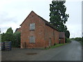
B60 4NZ is primarily an owner-occupied area, with 77% of homes owned by residents rather than rented. The accommodation type is predominantly houses, which aligns with the area’s rural character and the preference for traditional, spacious properties. This suggests a market tailored to families or individuals seeking larger living spaces, rather than a rental-focused demographic. The small size of the postcode means the housing stock is limited, and buyers may need to look beyond B60 4NZ itself to find a broader range of options. The focus on houses implies a lack of high-density development, which could be appealing to those prioritising privacy and outdoor space. However, the scarcity of properties also means competition is likely, and buyers should consider nearby areas for more choices. The low population density further reinforces the idea that this is not a high-turnover market, with properties likely to remain in the same hands for extended periods.
House Prices in B60 4NZ
No properties found in this postcode.
Energy Efficiency in B60 4NZ
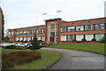
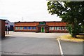
The lifestyle in B60 4NZ is defined by its rural setting and proximity to historical and natural features. Nearby amenities include five retail outlets such as Morrisons Charford, Aldi Aston, and Co-op Bromsgrove, providing essential shopping options. The Worcester and Birmingham Canal adds a scenic element, while the area’s history includes salt works and industrial heritage linked to John Corbett. Community events like the Stoke Prior Steam Rally, held annually in September, offer a unique local attraction. The Parish Church of St Michael and All Angels, dating to the 12th century, adds cultural value. While the area lacks high-density leisure facilities, the rail links to Bromsgrove and surrounding towns open up access to larger retail, dining, and entertainment options. The combination of historical sites, green spaces, and practical transport links creates a balanced lifestyle, blending quiet rural living with urban accessibility.
Amenities
Schools
The schools near B60 4NZ include Coach House School and Redgrove School, both special needs institutions, and Lokrum Fields, another special school with an Ofsted rating of satisfactory. These schools cater to students with specific educational needs, suggesting the area may attract families with children requiring tailored support. The absence of mainstream primary or secondary schools in the immediate vicinity means parents may need to look further afield for general education. However, the presence of multiple special schools indicates a local focus on inclusivity and specialist provision. For families with children in need of such services, the availability of three special schools within reach is a practical advantage. The Ofsted rating for Lokrum Fields, while not outstanding, suggests it meets minimum standards. Buyers should consider proximity to mainstream schools in surrounding areas if that is a priority.
| Rank | School | Type | Entry gender | Ages |
|---|
Explore more schools in this area
Go to Schools tabDemographics
The population of B60 4NZ is predominantly adults aged 30–64, with a median age of 47. This suggests a mature, settled community with a strong emphasis on family living. Home ownership is high at 77%, indicating a stable, long-term resident base. The area is largely composed of houses rather than flats, reflecting a preference for traditional, spacious dwellings. The predominant ethnic group is White, though no specific data on diversity or deprivation is provided. The low population density of 160 people per square kilometre implies a spread-out, possibly rural or semi-rural layout. For quality of life, the high home ownership rate and mature age profile suggest a community focused on comfort and continuity rather than rapid growth or change. The absence of specific deprivation data means it is reasonable to assume the area’s infrastructure meets basic needs, though this remains unconfirmed.
Household Size
Accommodation Type
Tenure
Ethnic Group
Religion
Household Composition
Age
Household Deprivation
NS-SEC
Explore more demographic insights in this area
Go to Demographics tabPlanning
Planning Constraints
- Flood RiskPremium
- Ramsar Wetland SitesPremium
- Area of Outstanding Natural BeautyPremium
- Protected Nature ReservePremium
- Protected WoodlandPremium