Area Overview for B60 4NU
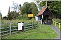
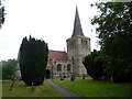
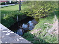
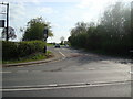
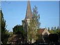
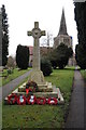
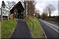
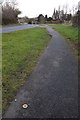
Photos of B60 4NU
Area Information
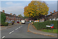
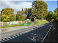
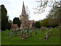
Living in B60 4NU means being part of a small, tightly knit residential cluster in Worcestershire’s Bromsgrove district. With a population of 1,275, this area reflects a quiet, rural character shaped by historical industries like salt works and canals. The village of Stoke Prior, near the Worcester and Birmingham Canal, anchors the area, offering a mix of traditional and modern living. Daily life here is defined by community events such as the Stoke Prior Steam Rally, which draws enthusiasts to local farms each September. The area’s proximity to rail networks and primary roads ensures practical connectivity, while the presence of Stoke Prior First School—a primary school rated Good by Ofsted—adds to its appeal for families. B60 4NU is not a sprawling suburb but a focused, low-density cluster where residents often know their neighbours, blending historical charm with modern amenities. Its small size means a strong sense of local identity, though it remains within reach of larger towns like Bromsgrove and Droitwich Spa. For those seeking a peaceful, community-oriented lifestyle with access to nature and transport, this postcode offers a balanced alternative to urban living.
- Area Type
- Postcode
- Area Size
- Not available
- Population
- 1275
- Population Density
- 1788 people/km²
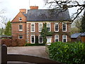
The property market in B60 4NU is dominated by owner-occupied homes, with 72% of residents owning their properties. This high ownership rate suggests a community of long-term residents rather than a transient rental market. The accommodation type is predominantly houses, which is typical of rural and semi-rural areas in England. This contrasts with urban centres where flats are more common, and it reflects a preference for private, standalone homes with garden space. The small population and limited area mean that the housing stock is not vast, but the focus on owner-occupation implies a steady demand from local buyers. For those considering the area, the scarcity of rental properties may indicate a need to act quickly if a property becomes available. The predominance of houses also means that buyers should expect larger plots and potential for outdoor living, though the exact size of properties is not specified in the data.
House Prices in B60 4NU
No properties found in this postcode.
Energy Efficiency in B60 4NU
Residents of B60 4NU have access to a range of retail and transport amenities within practical reach. Nearby shops include Morrisons Charford, Co-op Bromsgrove, and Aldi Aston, offering everyday essentials and groceries. These stores cater to both routine shopping and weekly provisions, reducing the need for long trips to larger towns. The rail network is particularly strong, with stations like Bromsgrove and Droitwich Spa providing regular services to major cities and employment hubs. The area’s rural character is complemented by its connectivity, allowing residents to enjoy a quiet lifestyle while remaining within commuting distance of urban centres. The presence of the Worcester and Birmingham Canal adds to the local appeal, offering scenic routes for leisure activities. These amenities collectively support a lifestyle that balances convenience with the tranquillity of a small village setting.
Amenities
Schools
The nearest school to B60 4NU is Stoke Prior First School, a primary school with a Good Ofsted rating. This rating indicates that the school meets national standards in teaching quality, pupil outcomes, and leadership. As a primary school, it serves children aged 4–11, making it a critical factor for families with young children. The absence of secondary schools in the immediate area means that students may need to travel to nearby towns like Bromsgrove or Droitwich Spa for secondary education. However, the Good rating at Stoke Prior First School suggests that the local education system provides a solid foundation for early learning. For families prioritising strong primary education, this school’s performance is a significant advantage, though they should plan for secondary schooling elsewhere.
| Rank | School | Type | Entry gender | Ages |
|---|
Explore more schools in this area
Go to Schools tabDemographics
The community in B60 4NU is predominantly composed of adults aged 30–64, with a median age of 47. This suggests a mature, stable population, likely with established careers and families. Home ownership is high at 72%, indicating a strong preference for long-term residency over rental properties. The area is characterised by houses rather than flats, reflecting a traditional, family-oriented housing stock. The predominant ethnic group is White, which aligns with broader trends in rural Worcestershire. While no specific data on deprivation is provided, the high home ownership rate and low crime score (79/100) imply a relatively secure, self-sufficient community. The absence of significant demographic diversity may appeal to those seeking a familiar cultural environment but could also mean limited exposure to broader social dynamics. For buyers, this profile suggests a market of existing residents prioritising stability over transient lifestyles.
Household Size
Accommodation Type
Tenure
Ethnic Group
Religion
Household Composition
Age
Household Deprivation
NS-SEC
Explore more demographic insights in this area
Go to Demographics tabPlanning
Planning Constraints
- Flood RiskPremium
- Ramsar Wetland SitesPremium
- Area of Outstanding Natural BeautyPremium
- Protected Nature ReservePremium
- Protected WoodlandPremium