Area Overview for B60 3YE
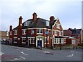
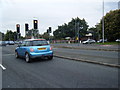
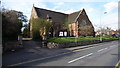
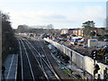
Photos of B60 3YE
Area Information
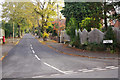
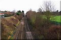
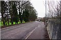
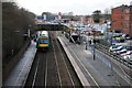
Living in B60 3YE means being part of a small, tightly knit residential cluster in Worcestershire’s West Midlands. With a population of 2,210 and a density of 251 people per square kilometre, this area balances quietude with practicality. The village of Tardebigge, centred around the postcode, is defined by its hilltop location overlooking the Worcester and Birmingham Canal, a historic waterway that once facilitated trade. The area’s character is steeped in history, from its Saxon-era church to the 18th-century St Bartholomew’s Church, which still dominates the skyline. Daily life here is shaped by proximity to nature, with the canal and surrounding green spaces offering a contrast to the modest retail and rail hubs nearby. The community is mature, with a median age of 47, and many residents are long-term homeowners. This is a place where heritage meets convenience, ideal for those seeking a stable, low-traffic environment with easy access to regional transport networks.
- Area Type
- Postcode
- Area Size
- Not available
- Population
- 2210
- Population Density
- 251 people/km²
The property market in B60 3YE is characterised by high home ownership—76% of residents live in homes they own—indicating a strong preference for private residence over rental properties. The area is predominantly composed of houses, which suggests a focus on family-friendly, spacious living arrangements. This contrasts with areas where flats or apartments dominate, and it aligns with the mature demographic profile of the community. The small size of the postcode area means that property availability is limited, and buyers should consider the surrounding regions for broader options. For those seeking a stable, low-traffic environment with historical and natural amenities, B60 3YE offers a niche market of owner-occupied homes. However, the lack of high-density housing may make it less suitable for those prioritising rental flexibility or urban proximity.
House Prices in B60 3YE
No properties found in this postcode.
Energy Efficiency in B60 3YE
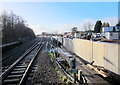
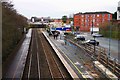
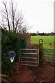
The lifestyle in B60 3YE is shaped by its proximity to both historical sites and practical amenities. Within reach are retail options such as Co-op Bromsgrove, Aldi Aston, and Morrisons Charford, providing everyday shopping convenience. The area’s heritage is reflected in places like Tardebigge Court, a retail village evolved from the Hewell Grange estate, and the Tardebigge Pub, formerly a village hall. The Worcester and Birmingham Canal runs through the parish, offering scenic walks and a connection to the area’s industrial past. For leisure, the canal’s old wharves and St Bartholomew’s Church provide quiet spaces for reflection or recreation. This blend of practicality and historical charm creates a lifestyle that balances convenience with a sense of place.
Amenities
Schools
The nearest school to B60 3YE is Tardebigge CofE First School, a primary institution with an Ofsted rating of ‘good’. This school serves the local community, offering education for younger children in a setting that blends tradition with modern pedagogy. The absence of secondary schools in the immediate area means families may need to consider commuting to nearby towns for secondary education. However, the ‘good’ rating indicates a reliable standard of teaching and facilities, which is crucial for parents prioritising quality education. The presence of a primary school within reach supports the area’s appeal to families, though the limited range of educational institutions may necessitate planning for longer-term schooling needs.
| Rank | School | Type | Entry gender | Ages |
|---|
Explore more schools in this area
Go to Schools tabDemographics
The population of B60 3YE is predominantly adults aged 30–64, with a median age of 47. This suggests a community of established professionals and families, many of whom are homeowners—76% of residents own their homes, a figure higher than the national average. The area is primarily composed of houses rather than flats, reflecting a preference for single-family living. The predominant ethnic group is White, though specific data on diversity is not provided. The relatively low population density of 251 people per square kilometre indicates a spread-out, less congested environment. This demographic profile points to a stable, mature community with strong ties to local institutions, such as the Tardebigge CofE First School, which serves the area. The high home ownership rate suggests long-term residency and a focus on quality of life over transient living.
Household Size
Accommodation Type
Tenure
Ethnic Group
Religion
Household Composition
Age
Household Deprivation
NS-SEC
Explore more demographic insights in this area
Go to Demographics tabPlanning
Planning Constraints
- Flood RiskPremium
- Ramsar Wetland SitesPremium
- Area of Outstanding Natural BeautyPremium
- Protected Nature ReservePremium
- Protected WoodlandPremium