Area Overview for B60 3JD
Photos of B60 3JD
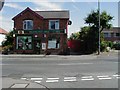
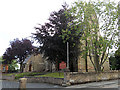
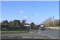
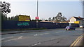
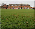
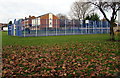
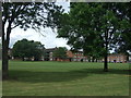
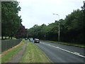
39 photos from this area
Area Information
Key information about the B60 3JD including its size, population, and administrative classification.
- Area Type
- Postcode
- Area Size
- 1.1 hectares
- Population
- 2011
- Population Density
- 5091 people/km²
House Prices in B60 3JD
24
Properties
£131,744
Average Sold Price
£49,950
Lowest Price
£230,000
Highest Price
Showing 24 properties
| Address | Type | Beds | Baths | Last Sale Price | Last Sale Date | |
|---|---|---|---|---|---|---|
| 36 Humphrey Avenue, Bromsgrove, B60 3JD | Semi-detached | 3 | 1 | £230,000 | Jun 2023 | |
| 24 Humphrey Avenue, Bromsgrove, B60 3JD | Semi-detached | 2 | 1 | £210,000 | Aug 2022 | |
| 30 Humphrey Avenue, Bromsgrove, B60 3JD | Semi-detached | 3 | 1 | £210,000 | Aug 2020 | |
| 37 Humphrey Avenue, Bromsgrove, B60 3JD | house | 3 | - | £115,000 | May 2012 | |
| 49 Humphrey Avenue, Bromsgrove, B60 3JD | Terraced | 3 | 1 | £116,500 | Jul 2010 | |
| 59 Humphrey Avenue, Bromsgrove, B60 3JD | Semi-detached | - | - | £67,000 | Apr 2000 | |
| 47 Humphrey Avenue, Bromsgrove, B60 3JD | Terraced | 3 | 1 | £55,500 | Sep 1999 | |
| 34 Humphrey Avenue, Bromsgrove, B60 3JD | house | - | - | £49,950 | Mar 1996 | |
| 39 Humphrey Avenue, Bromsgrove, B60 3JD | house | 4 | - | - | - | |
| 18 Humphrey Avenue, Bromsgrove, B60 3JD | house | 2 | - | - | - |
Page 1 of 3
Energy Efficiency in B60 3JD
Amenities
Schools
| Rank | School | Type | Entry gender | Ages |
|---|
Explore more schools in this area
Go to Schools tabDemographics
Household Size
One person
most common
Accommodation Type
Houses
most common
Tenure
51
majority
Ethnic Group
White
most common
Religion
N/A
most common
Household Composition
N/A
most common
Age
47
median
Adults (30-64 years)
most common
Household Deprivation
N/A
with no deprivation
NS-SEC
22
in Lower managerial occupations
Explore more demographic insights in this area
Go to Demographics tabPlanning
Planning Constraints
- Flood RiskPremium
- Ramsar Wetland SitesPremium
- Area of Outstanding Natural BeautyPremium
- Protected Nature ReservePremium
- Protected WoodlandPremium