Area Overview for B60 3HG
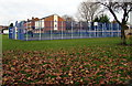
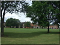
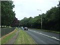
Photos of B60 3HG

Area Information
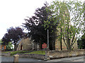
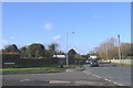
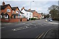
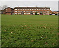
B60 3HG is a small residential postcode area nestled in Bromsgrove, Worcestershire, part of the West Midlands. With a population of 1,430, it is a compact cluster of homes within the broader Bromsgrove town, located 16 miles north-east of Worcester and 13 miles south-west of Birmingham. The area is defined by local government boundaries, centred around coordinates 52.322296, -2.061444. It is a quiet, established community with a stable demographic profile. Daily life here is characterised by proximity to essential services, including retail outlets and rail links. The postcode falls within the Charford electoral ward, which has a population estimate of around 2,431 to 3,260 depending on the source. Living in B60 3HG offers a blend of residential tranquillity and practical connectivity to nearby urban centres, making it suitable for those seeking a balanced lifestyle with access to both small-town charm and regional infrastructure.
- Area Type
- Postcode
- Area Size
- Not available
- Population
- 1430
- Population Density
- 2148 people/km²
The property market in B60 3HG is characterised by a high proportion of owner-occupied homes, with 61% of properties owned by residents. This suggests a stable, long-term community with limited rental activity. The accommodation type is predominantly houses, indicating a focus on family homes and suburban living. As a small postcode area, the housing stock is likely limited in scale, with fewer high-density developments. Buyers should consider that the area’s compact size may mean competition for properties, particularly given the appeal of home ownership. The presence of houses rather than flats or apartments may cater to those prioritising space and privacy. For those seeking investment opportunities, the market’s stability and low turnover could be advantageous, though the limited size of the area may restrict options for buyers looking for a wider selection.
House Prices in B60 3HG
No properties found in this postcode.
Energy Efficiency in B60 3HG
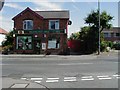
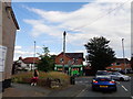
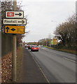
Residents of B60 3HG have access to a range of nearby amenities, including retail outlets and rail stations. The area’s retail options include Aldi Aston, Morrisons Charford, and Co-op Bromsgrove, offering convenience for daily shopping needs. These stores provide a mix of supermarket and local retail services, supporting a practical lifestyle. The proximity to rail stations such as Bromsgrove, Barnt Green, and Alvechurch adds to the area’s appeal, enabling easy travel to nearby towns and cities. While the data does not mention parks or leisure facilities directly, the absence of planning constraints like AONB or protected woodlands suggests open spaces may be available. The combination of retail access, rail connectivity, and a small-town setting contributes to a lifestyle that balances convenience with a sense of community.
Amenities
Schools
The nearest school to B60 3HG is Charford First School, which operates as both a primary school and an academy. This dual designation suggests it may be part of a larger educational trust or have a specific governance structure. As a primary school, it serves younger children, while its academy status could imply additional resources or autonomy in curriculum design. The presence of a single named school in the data means families in the area have a clear local option for primary education. However, the lack of secondary school information in the data means parents may need to consider commuting to nearby towns for higher education. The school’s role as both a primary and academy may offer a consistent educational pathway for students, though further details on its performance or Ofsted rating are not provided.
| Rank | School | Type | Entry gender | Ages |
|---|
Explore more schools in this area
Go to Schools tabDemographics
The community in B60 3HG is predominantly composed of adults aged 30–64, with a median age of 47. This suggests a mature, settled population, likely including families and professionals. Home ownership is high at 61%, indicating a stable housing market and long-term residency. The accommodation type is primarily houses, reflecting a suburban or semi-rural character. The predominant ethnic group is White, though no specific data on diversity or deprivation levels is provided. The age profile implies a community with established careers and families, which may influence local amenities and services. The absence of detailed diversity statistics means the area’s cultural composition remains less defined, but the high home ownership and age range suggest a cohesive, long-term resident base.
Household Size
Accommodation Type
Tenure
Ethnic Group
Religion
Household Composition
Age
Household Deprivation
NS-SEC
Explore more demographic insights in this area
Go to Demographics tabPlanning
Planning Constraints
- Flood RiskPremium
- Ramsar Wetland SitesPremium
- Area of Outstanding Natural BeautyPremium
- Protected Nature ReservePremium
- Protected WoodlandPremium