Area Overview for B60 3DU
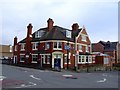
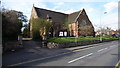
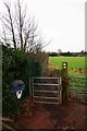
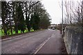
Photos of B60 3DU


Area Information
Living in B60 3DU means being part of a small, tightly knit residential cluster in Worcestershire, south of Bromsgrove. The postcode covers around 1,430 residents, reflecting a quiet, community-focused environment. Historically, the area was shaped by the Bromsgrove railway works, established in 1841 and operational until 1964. Today, the village retains echoes of its industrial past while offering modern comforts. Bromsgrove railway station, just a short distance away, connects residents to broader networks, though journey times to major cities are not specified. The area is served by Charford First School, a primary academy, and is within reach of retail outlets like Aldi, Co-op, and Morrisons. With a median age of 47, the population skews towards adults aged 30–64, suggesting a mix of established families and professionals. Daily life here balances practicality with a sense of local identity, supported by nearby rail links and a low flood risk. For those seeking a compact, accessible community with historical roots, B60 3DU offers a distinct blend of stability and convenience.
- Area Type
- Postcode
- Area Size
- Not available
- Population
- 1430
- Population Density
- 2148 people/km²
The property market in B60 3DU is characterised by a 61% home ownership rate, indicating a strong presence of owner-occupied homes. The accommodation type is predominantly houses, which may appeal to families or individuals seeking more space. Given the area’s small size and limited data on rental activity, it is likely a mix of long-term residents and fewer rental properties. The focus on houses suggests a market skewed towards established homes rather than newer developments or apartments. For buyers, this means a limited selection of properties, potentially increasing competition among local buyers. The proximity to Bromsgrove and rail links may enhance property value by offering connectivity to employment hubs. However, the small population and cluster nature of the postcode mean the housing stock is unlikely to expand significantly, making it a niche market for those prioritising stability and local community ties over broader urban amenities.
House Prices in B60 3DU
No properties found in this postcode.
Energy Efficiency in B60 3DU
The lifestyle in B60 3DU is supported by nearby amenities that cater to daily needs. Retail options include Aldi Aston, Co-op Bromsgrove, and Morrisons Charford, providing access to groceries, household goods, and convenience services. The rail network, with stations at Bromsgrove, Barnt Green, and Alvechurch, offers connectivity to broader destinations, though specific routes and frequencies are not detailed. The area’s historical ties to the Bromsgrove railway works add a layer of industrial heritage to its character. While parks or leisure facilities are not explicitly mentioned, the proximity to Bromsgrove may offer additional recreational opportunities. The combination of practical retail access and rail links suggests a lifestyle focused on convenience and accessibility, with the small community size fostering a sense of familiarity among residents.
Amenities
Schools
The nearest school to B60 3DU is Charford First School, which operates as both a primary school and an academy. While only one school is explicitly listed in the data, its dual designation suggests a focus on foundational education with potential for specialised curricula typical of academy status. The presence of a primary school within practical reach supports families with young children, though secondary education options are not detailed. The school’s role as an academy may indicate autonomy in teaching methods or governance, which could be a consideration for parents seeking specific educational approaches. However, the lack of additional schools in the data means families may need to look further afield for secondary education. The availability of a primary school is a key factor for buyers prioritising ease of access to education for their children.
| Rank | School | Type | Entry gender | Ages |
|---|
Explore more schools in this area
Go to Schools tabDemographics
The population of B60 3DU is 1,430, with a median age of 47, indicating a mature demographic. The most common age range is 30–64 years, suggesting a community of working-age adults and older residents. Home ownership stands at 61%, reflecting a majority of owner-occupied properties, while the accommodation type is predominantly houses, which may cater to families or those preferring larger living spaces. The predominant ethnic group is White, though specific diversity metrics are not detailed. This age profile implies a stable, long-term resident base, with fewer young families or retirees compared to other areas. The absence of explicit deprivation data means quality of life factors such as access to services and employment opportunities are inferred from proximity to Bromsgrove and nearby amenities. The demographic structure suggests a focus on practical living over transient lifestyles, with a reliance on local infrastructure and community networks.
Household Size
Accommodation Type
Tenure
Ethnic Group
Religion
Household Composition
Age
Household Deprivation
NS-SEC
Explore more demographic insights in this area
Go to Demographics tabPlanning
Planning Constraints
- Flood RiskPremium
- Ramsar Wetland SitesPremium
- Area of Outstanding Natural BeautyPremium
- Protected Nature ReservePremium
- Protected WoodlandPremium