Area Overview for B60 3DQ
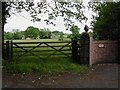
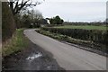
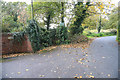
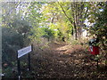
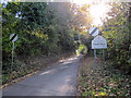
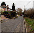
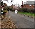
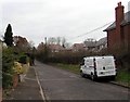
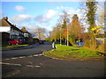
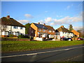
Photos of B60 3DQ


Area Information
Living in B60 3DQ, a small residential cluster in Worcestershire, offers a quiet, low-density lifestyle. With a population of 1,137 and a density of 43 people per square kilometre, this area feels spacious and uncluttered. Situated in the village of Finstall, it lies within the Bromsgrove District, close to larger towns like Bromsgrove and Alvechurch. The area’s character is defined by its modest scale and proximity to regional transport links. Residents benefit from nearby railway stations, including Bromsgrove and Barnt Green, which connect to Birmingham and beyond. Daily life here is shaped by a mix of rural tranquillity and practical access to retail and services. The presence of supermarkets like Co-op, Lidl, and Iceland within walking distance ensures convenience, while the area’s small size means amenities are never far. Though the population is modest, the community is tightly knit, with a median age of 47 and a majority of residents aged 30–64. This suggests a stable, established demographic, with homes primarily occupied by owner-occupiers. For those seeking a peaceful, low-traffic environment with reliable connectivity, B60 3DQ presents a compelling option.
- Area Type
- Postcode
- Area Size
- Not available
- Population
- 1137
- Population Density
- 43 people/km²
The property market in B60 3DQ is characterised by a high rate of home ownership—85%—and a predominance of houses over flats or other accommodation types. This suggests a suburban, family-oriented environment where residents are likely to have long-term ties to the area. The small population and low density mean the housing stock is limited, with fewer properties available compared to larger urban centres. For buyers, this could translate to competition for available homes, particularly as the area’s proximity to Bromsgrove and Alvechurch may attract those seeking a quieter alternative to city living. The focus on owner-occupation rather than rental properties indicates a stable market, though the limited size of B60 3DQ means buyers should consider nearby areas for broader options. The presence of railway stations within practical reach also enhances the area’s appeal for commuters, offering flexibility for those working in nearby towns or cities.
House Prices in B60 3DQ
No properties found in this postcode.
Energy Efficiency in B60 3DQ
Life in B60 3DQ is shaped by its proximity to essential amenities, with five retail outlets within practical reach. These include Co-op Bromsgrove, Lidl Bromsgrove, and Iceland Bromsgrove, providing everyday shopping needs without the need for long journeys. The area’s small size ensures these services are easily accessible, supporting a convenient, self-contained lifestyle. For transport, the nearby railway stations—Bromsgrove, Barnt Green, and Alvechurch—offer direct links to larger towns and cities, enhancing connectivity for commuters and shoppers. While the area lacks large parks or leisure facilities, its rural setting within Finstall likely provides green spaces for walking or recreation. The combination of retail convenience, rail access, and a quiet environment creates a balanced lifestyle, ideal for those seeking a mix of tranquillity and practicality. Residents benefit from the ease of accessing daily essentials while maintaining a sense of community in a low-density, suburban setting.
Amenities
Schools
| Rank | School | Type | Entry gender | Ages |
|---|
Explore more schools in this area
Go to Schools tabDemographics
The community in B60 3DQ is predominantly composed of adults aged 30–64, with a median age of 47. This suggests a mature, stable population, likely with long-term ties to the area. Home ownership is high, at 85%, indicating a strong sense of local investment and permanence. The accommodation type is largely houses, which aligns with the area’s low density and suburban character. The predominant ethnic group is White, reflecting the broader demographic patterns of the West Midlands region. With a population of 1,137, the area’s small size means social networks are likely close-knit, though the exact level of diversity is not specified. The age profile implies a mix of working-age residents and those nearing retirement, which may influence local services and amenities. The absence of specific data on deprivation or income levels means these factors remain unquantified, but the high home ownership rate and mature age range suggest a relatively secure economic profile.
Household Size
Accommodation Type
Tenure
Ethnic Group
Religion
Household Composition
Age
Household Deprivation
NS-SEC
Explore more demographic insights in this area
Go to Demographics tabPlanning
Planning Constraints
- Flood RiskPremium
- Ramsar Wetland SitesPremium
- Area of Outstanding Natural BeautyPremium
- Protected Nature ReservePremium
- Protected WoodlandPremium