Area Overview for B60 3DP
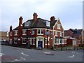
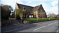
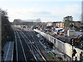
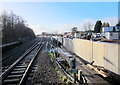
Photos of B60 3DP


Area Information
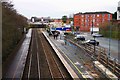
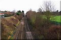
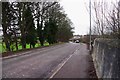
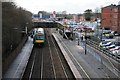
Living in B60 3DP means being part of a small, tightly knit residential cluster in Bromsgrove, Worcestershire. With a population of just 1,430, the area feels quiet and unassuming, far removed from the bustling centres of larger cities. Situated to the south of Bromsgrove, it sits within a historically significant landscape shaped by the Bromsgrove railway works, established in 1841. This area is not to be confused with the Aston district of Birmingham; it is a distinct village with its own character. Daily life here is defined by proximity to Bromsgrove railway station, which connects residents to broader networks. The community is predominantly composed of adults aged 30–64, with a median age of 47, suggesting a stable, mature demographic. While the area lacks large-scale amenities, its small size fosters a sense of familiarity. For those seeking a low-maintenance lifestyle with access to essential services, B60 3DP offers a quiet alternative to more densely populated regions, though its limited size means residents must look beyond the immediate area for major facilities.
- Area Type
- Postcode
- Area Size
- Not available
- Population
- 1430
- Population Density
- 2148 people/km²
B60 3DP is a predominantly owner-occupied area, with 61% of properties owned by residents rather than rented. The housing stock is largely composed of houses, which is unusual in smaller postcode areas that often feature more flats or terraced homes. This suggests a focus on single-family living, potentially appealing to those seeking space and privacy. However, the small size of the area means the housing market is limited, with few properties available for sale or rent. Buyers should consider the proximity to Bromsgrove and surrounding towns for broader options. The dominance of owner-occupied homes indicates a stable market, but the lack of rental properties may make it challenging for those seeking short-term accommodation. For those interested in purchasing, the area offers a quiet, low-density environment, though its small size means residents must look beyond B60 3DP for larger amenities or services.
House Prices in B60 3DP
No properties found in this postcode.
Energy Efficiency in B60 3DP
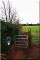
The lifestyle in B60 3DP is shaped by its proximity to Bromsgrove and the availability of nearby amenities. Within practical reach are retail options such as Aldi Aston, Morrisons Charford, and Co-op Bromsgrove, providing access to groceries, household goods, and everyday essentials. The area’s rail stations—Bromsgrove, Barnt Green, and Alvechurch—offer connections to broader networks, though the lack of specific journey times means residents must plan travel based on general knowledge of regional routes. Parks and green spaces are not explicitly mentioned in the data, but the absence of planning constraints like AONB or protected woodlands suggests the area may have open spaces for recreation. The quiet, residential nature of B60 3DP means leisure activities are likely centred around local shops, rail travel, and nearby towns. While the area lacks large-scale entertainment or dining options, its simplicity and accessibility to Bromsgrove make it suitable for those seeking a low-key, community-focused lifestyle.
Amenities
Schools
The nearest schools to B60 3DP include Charford First School, which operates as both a primary school and an academy. While no Ofsted ratings are provided, the presence of two entries for the same institution suggests it may serve multiple age groups or have distinct departments. The mix of primary and academy status implies a range of educational approaches, though it is unclear whether this offers diverse options for families. Given the area’s small size, parents may need to look beyond B60 3DP for secondary schools or specialist provisions. The lack of additional schools in the data means the educational landscape is limited, with families likely relying on Bromsgrove or nearby towns for broader schooling choices. For those prioritising proximity to schools, the availability of Charford First School is a key consideration, though its capacity and performance remain unspecified.
| Rank | School | Type | Entry gender | Ages |
|---|
Explore more schools in this area
Go to Schools tabDemographics
The population of B60 3DP is 1,430, with a median age of 47. The majority of residents fall within the 30–64 age range, indicating a community of established adults. Home ownership is strong, with 61% of properties occupied by their owners, compared to 39% rented. The area is primarily composed of houses, reflecting a preference for single-family dwellings over flats or apartments. The predominant ethnic group is White, though no specific data on diversity or minority representation is provided. The age profile suggests a community focused on stability, with fewer young families or retirees compared to other areas. This demographic balance may influence local services and amenities, which are tailored to the needs of middle-aged residents. The absence of detailed diversity statistics means the area’s cultural makeup remains less defined in the data, though the population size and age distribution point to a relatively homogeneous community.
Household Size
Accommodation Type
Tenure
Ethnic Group
Religion
Household Composition
Age
Household Deprivation
NS-SEC
Explore more demographic insights in this area
Go to Demographics tabPlanning
Planning Constraints
- Flood RiskPremium
- Ramsar Wetland SitesPremium
- Area of Outstanding Natural BeautyPremium
- Protected Nature ReservePremium
- Protected WoodlandPremium