Area Overview for B60 2LF
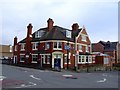
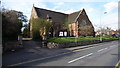
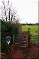
Photos of B60 2LF


Area Information
Living in B60 2LF means inhabiting a small, defined residential cluster in Worcestershire, south of Bromsgrove. With a population of 1,317, the area is compact yet distinct, avoiding the density of larger towns. Its history is rooted in industrial heritage, notably the Bromsgrove railway works established in 1841, which shaped the local economy until its closure in 1964. Today, the area is served by Bromsgrove railway station, offering connectivity to nearby towns. The postcode sits within a quiet, suburban setting, with no major urban sprawl. Residents benefit from proximity to Bromsgrove’s amenities while retaining a village-like character. The area’s low flood risk and absence of protected natural sites make it a practical choice for families and professionals seeking stability. Its modest size means community interactions are likely to be close-knit, though the lack of detailed economic data leaves current employment trends unexplored. For those prioritising safety and practicality, B60 2LF offers a straightforward, low-maintenance lifestyle.
- Area Type
- Postcode
- Area Size
- Not available
- Population
- 1317
- Population Density
- 5714 people/km²
The property market in B60 2LF is characterised by a high rate of home ownership (62%) and a predominance of houses. This suggests a suburban, family-oriented area where detached or semi-detached homes are the norm. The small population and compact size of the postcode mean the housing stock is limited, likely concentrated around Bromsgrove and its immediate surroundings. As an owner-occupied area, the market may be less influenced by rental demand, though the lack of detailed data on property prices or availability makes it difficult to assess competitiveness. Buyers should consider the area’s proximity to Bromsgrove’s amenities and transport links, which could enhance property value. However, the limited size of B60 2LF means housing options are restricted, potentially reducing choice for buyers seeking specific property types or sizes. The absence of high-rise or rental-focused developments indicates a quiet, low-density environment suited to those prioritising space and community over urban convenience.
House Prices in B60 2LF
No properties found in this postcode.
Energy Efficiency in B60 2LF
Residents of B60 2LF have access to a range of local amenities within practical reach. The retail sector includes five notable stores, such as Co-op Bromsgrove, Aldi Aston, and Morrisons Charford, providing essential shopping options. These venues cater to daily needs, from groceries to household supplies, reducing the need for long trips. The area’s railway stations—Bromsgrove, Barnt Green, and Alvechurch—offer connectivity to broader networks, though the specific destinations are not detailed. The presence of multiple stations suggests a degree of convenience for commuters. While the data does not mention parks or leisure facilities, the absence of planning constraints like AONB or protected woodlands implies space for informal outdoor activities. The combination of retail access and transport links creates a lifestyle that balances local convenience with suburban tranquillity.
Amenities
Schools
| Rank | School | Type | Entry gender | Ages |
|---|
Explore more schools in this area
Go to Schools tabDemographics
The population of B60 2LF is 1,317, with a median age of 47, indicating a mature demographic. Most residents fall within the 30-64 age range, suggesting a stable adult population with established careers and families. Home ownership is high at 62%, reflecting a community where property is predominantly owner-occupied rather than rented. The accommodation type is largely houses, which aligns with the area’s suburban character. The predominant ethnic group is White, though no specific diversity metrics are provided. The absence of data on deprivation means no direct conclusions can be drawn about economic hardship, but the high home ownership rate and age profile suggest a relatively secure, middle-aged population. This demographic profile implies a community focused on long-term stability, with limited turnover in housing. The lack of younger households may influence local services and amenities, though the area’s retail and transport options suggest they cater to a broad age range.
Household Size
Accommodation Type
Tenure
Ethnic Group
Religion
Household Composition
Age
Household Deprivation
NS-SEC
Explore more demographic insights in this area
Go to Demographics tabPlanning
Planning Constraints
- Flood RiskPremium
- Ramsar Wetland SitesPremium
- Area of Outstanding Natural BeautyPremium
- Protected Nature ReservePremium
- Protected WoodlandPremium