Area Overview for B60 2FN
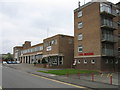
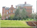
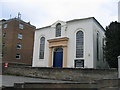
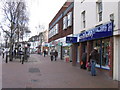
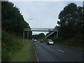
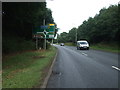
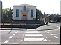
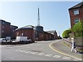
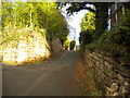
Photos of B60 2FN


Area Information
Living in B60 2FN offers a quiet, residential experience in a small cluster of homes with a population of 1,855. This area is characterised by its mature demographic, with a median age of 47 and a strong presence of adults aged 30–64. The community is largely owner-occupied, with 93% of homes in private ownership, suggesting a stable, long-term resident base. Daily life here is shaped by proximity to essential services, including five retail outlets such as Co-op Bromsgrove, Waitrose Bromsgrove, and Lidl Bromsgrove. Commuters benefit from nearby railway stations like Bromsgrove, Barnt Green, and Alvechurch, offering connections to regional transport networks. The area’s low crime risk—scoring 90/100—adds to its appeal, while digital connectivity is robust, with broadband and mobile coverage rated excellent and good respectively. B60 2FN is ideal for those seeking a balanced lifestyle with access to retail, transport, and a safe, low-maintenance environment. Its small size means a close-knit community feel, though it lacks major urban amenities, making it suitable for those prioritising tranquillity over city conveniences.
- Area Type
- Postcode
- Area Size
- Not available
- Population
- 1855
- Population Density
- 5318 people/km²
The property market in B60 2FN is dominated by owner-occupied homes, with 93% of properties in private hands. This high ownership rate suggests a stable market with limited rental activity, making it less attractive to investors seeking short-term returns. The accommodation type is predominantly houses, which may indicate a focus on family homes or larger properties. This contrasts with areas where flats or apartments dominate, and it may appeal to buyers prioritising space and privacy. The small population of 1,855 means the housing stock is likely limited in scale, with limited scope for new developments. For buyers, this could mean fewer choices but potentially more established properties with strong community ties. The lack of rental demand may also mean property values are less volatile, though the data does not provide specific price trends. Overall, B60 2FN appears suited to those seeking a settled, low-maintenance home in a residential setting.
House Prices in B60 2FN
No properties found in this postcode.
Energy Efficiency in B60 2FN
Residents of B60 2FN have access to a range of nearby amenities, including five retail outlets such as Co-op Bromsgrove, Waitrose Bromsgrove, and Lidl Bromsgrove. These stores offer everyday essentials, from groceries to household items, supporting a self-contained lifestyle. The area’s railway stations—Bromsgrove, Barnt Green, and Alvechurch—provide direct links to regional hubs, enhancing accessibility for shopping, work, or leisure. While the data does not mention parks or recreational spaces, the proximity to retail and transport suggests a practical, convenience-driven lifestyle. The absence of detailed information on dining or leisure venues means the area’s social scene remains undefined, though the retail options imply a focus on functional rather than experiential amenities. For those prioritising ease of access to services and reliable transport, B60 2FN offers a straightforward, low-maintenance environment.
Amenities
Schools
| Rank | School | Type | Entry gender | Ages |
|---|
Explore more schools in this area
Go to Schools tabDemographics
The community in B60 2FN is predominantly composed of adults aged 30–64, with a median age of 47. This suggests a mature population, likely with established careers and families. Home ownership is exceptionally high at 93%, indicating a stable, long-term resident base with fewer renters. The accommodation type is primarily houses, which aligns with the area’s residential character and may cater to larger households. The predominant ethnic group is White, reflecting a homogenous demographic profile. While the data does not specify deprivation levels, the high home ownership and low crime risk imply a generally affluent and secure environment. However, the absence of detailed diversity metrics means the area’s social composition remains largely unexplored in the data. The age profile suggests a community with strong ties to local institutions, such as schools and retail, though specific educational or social infrastructure details are not provided.
Household Size
Accommodation Type
Tenure
Ethnic Group
Religion
Household Composition
Age
Household Deprivation
NS-SEC
Explore more demographic insights in this area
Go to Demographics tabPlanning
Planning Constraints
- Flood RiskPremium
- Ramsar Wetland SitesPremium
- Area of Outstanding Natural BeautyPremium
- Protected Nature ReservePremium
- Protected WoodlandPremium