Area Overview for B60 1PZ
Photos of B60 1PZ
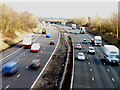
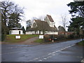
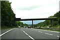
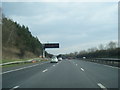
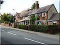
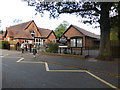
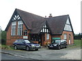
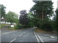
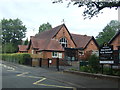
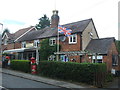


32 photos from this area
Area Information
Key information about the B60 1PZ including its size, population, and administrative classification.
- Area Type
- Postcode
- Area Size
- 6.0 hectares
- Population
- 1196
- Population Density
- 271 people/km²
House Prices in B60 1PZ
28
Properties
£444,326
Average Sold Price
£170,000
Lowest Price
£875,000
Highest Price
Showing 28 properties
| Address | Type | Beds | Baths | Last Sale Price | Last Sale Date | |
|---|---|---|---|---|---|---|
| 3, Station Cottages, Station Road, Blackwell, B60 1PZ | house | 2 | - | £335,000 | Dec 2023 | |
| Meadow View, 26 Station Road, Blackwell, B60 1PZ | Detached | 4 | 2 | £875,000 | Feb 2023 | |
| 6, Station Cottages, Station Road, Blackwell, B60 1PZ | Detached | 3 | 1 | £340,000 | Jan 2021 | |
| High Bank House, 32 Station Road, Blackwell, B60 1PZ | Detached | 6 | 4 | £770,000 | Oct 2020 | |
| 5, Station Cottages, Station Road, Blackwell, B60 1PZ | Semi-detached | 3 | 2 | £265,000 | Oct 2018 | |
| Heather Bank, 28 Station Road, Blackwell, B60 1PZ | house | - | - | £661,500 | Feb 2018 | |
| New Station House, 28A Station Road, Blackwell, B60 1PZ | Detached | 5 | 3 | £350,050 | Jan 2018 | |
| 16 Station Road, Blackwell, B60 1PZ | Bungalow | - | - | £555,000 | May 2017 | |
| 10 Station Road, Blackwell, B60 1PZ | Bungalow | - | - | £500,000 | Jan 2017 | |
| 4, Station Cottages, Station Road, Blackwell, B60 1PZ | house | 2 | - | £195,000 | Mar 2015 |
Page 1 of 3
Energy Efficiency in B60 1PZ
Amenities
Schools
| Rank | School | Type | Entry gender | Ages |
|---|
Explore more schools in this area
Go to Schools tabDemographics
Household Size
Two person
most common
Accommodation Type
Houses
most common
Tenure
88
majority
Ethnic Group
White
most common
Religion
N/A
most common
Household Composition
N/A
most common
Age
47
median
Adults (30-64 years)
most common
Household Deprivation
N/A
with no deprivation
NS-SEC
50
in Lower managerial occupations
Explore more demographic insights in this area
Go to Demographics tabPlanning
Planning Constraints
- Flood RiskPremium
- Ramsar Wetland SitesPremium
- Area of Outstanding Natural BeautyPremium
- Protected Nature ReservePremium
- Protected WoodlandPremium