Area Overview for B60 1HN
Photos of B60 1HN
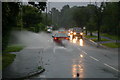

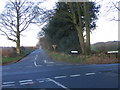
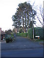
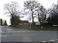
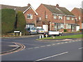

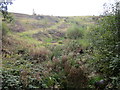
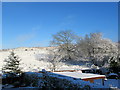
79 photos from this area
Area Information
Key information about the B60 1HN including its size, population, and administrative classification.
- Area Type
- Postcode
- Area Size
- 11.1 hectares
- Population
- 1452
- Population Density
- 737 people/km²
House Prices in B60 1HN
28
Properties
£290,561
Average Sold Price
£137,000
Lowest Price
£620,000
Highest Price
Showing 28 properties
| Address | Type | Beds | Baths | Last Sale Price | Last Sale Date | |
|---|---|---|---|---|---|---|
| 16A Marlbrook Lane, Marlbrook, B60 1HN | Semi-detached | 3 | 1 | £320,000 | Mar 2025 | |
| 48 Marlbrook Lane, Marlbrook, B60 1HN | Detached | 4 | 2 | £482,250 | Oct 2022 | |
| 12 Marlbrook Lane, Marlbrook, B60 1HN | Retail | 4 | 2 | £620,000 | Oct 2022 | |
| 44 Marlbrook Lane, Marlbrook, B60 1HN | Semi-detached | 3 | 1 | £390,000 | Mar 2021 | |
| 8 Marlbrook Lane, Marlbrook, B60 1HN | Detached | 3 | 2 | £365,000 | Dec 2020 | |
| 16 Marlbrook Lane, Marlbrook, B60 1HN | house | - | - | £265,000 | Sep 2018 | |
| 4 Marlbrook Lane, Marlbrook, B60 1HN | house | - | - | £283,000 | Aug 2016 | |
| 24 Marlbrook Lane, Marlbrook, B60 1HN | Detached | 4 | 2 | £372,500 | Nov 2014 | |
| 46 Marlbrook Lane, Marlbrook, B60 1HN | Detached | 3 | 1 | £270,000 | Aug 2014 | |
| 2 Marlbrook Lane, Marlbrook, B60 1HN | Detached | 5 | - | £225,000 | Nov 2008 |
Page 1 of 3
Energy Efficiency in B60 1HN
Amenities
Schools
| Rank | School | Type | Entry gender | Ages |
|---|
Explore more schools in this area
Go to Schools tabDemographics
Household Size
Two person
most common
Accommodation Type
Houses
most common
Tenure
92
majority
Ethnic Group
White
most common
Religion
N/A
most common
Household Composition
N/A
most common
Age
47
median
Adults (30-64 years)
most common
Household Deprivation
N/A
with no deprivation
NS-SEC
49
in Lower managerial occupations
Explore more demographic insights in this area
Go to Demographics tabPlanning
Planning Constraints
- Flood RiskPremium
- Ramsar Wetland SitesPremium
- Area of Outstanding Natural BeautyPremium
- Protected Nature ReservePremium
- Protected WoodlandPremium