Area Overview for B60 1GE
Photos of B60 1GE
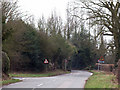
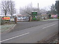
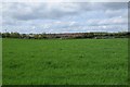
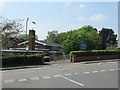
20 photos from this area
Area Information
Key information about the B60 1GE including its size, population, and administrative classification.
- Area Type
- Postcode
- Area Size
- 1.5 hectares
- Population
- 1687
- Population Density
- 1753 people/km²
House Prices in B60 1GE
34
Properties
£261,383
Average Sold Price
£125,000
Lowest Price
£462,500
Highest Price
Showing 34 properties
| Address | Type | Beds | Baths | Last Sale Price | Last Sale Date | |
|---|---|---|---|---|---|---|
| 39 Briar Close, Lickey End, B60 1GE | Detached | 5 | 2 | £462,500 | Oct 2025 | |
| 18 Briar Close, Lickey End, B60 1GE | Detached | 4 | 2 | £405,000 | Jul 2022 | |
| 27 Briar Close, Lickey End, B60 1GE | house | - | - | £385,000 | Aug 2021 | |
| 41 Briar Close, Lickey End, B60 1GE | Detached | 4 | 2 | £450,000 | Jan 2021 | |
| 37 Briar Close, Lickey End, B60 1GE | Detached | 4 | 2 | £340,000 | Oct 2020 | |
| 3 Briar Close, Lickey End, B60 1GE | Detached | 4 | 1 | £365,000 | Mar 2019 | |
| 16 Briar Close, Lickey End, B60 1GE | Detached | 4 | 2 | £345,000 | Oct 2018 | |
| 47 Briar Close, Lickey End, B60 1GE | Detached | 4 | - | £285,000 | Oct 2015 | |
| 15 Briar Close, Lickey End, B60 1GE | house | - | - | £240,000 | Sep 2011 | |
| 2 Briar Close, Lickey End, B60 1GE | house | 4 | - | £302,000 | Mar 2011 |
Page 1 of 4
Energy Efficiency in B60 1GE
Amenities
Schools
| Rank | School | Type | Entry gender | Ages |
|---|
Explore more schools in this area
Go to Schools tabDemographics
Household Size
Family (3-5 people)
most common
Accommodation Type
Houses
most common
Tenure
94
majority
Ethnic Group
White
most common
Religion
N/A
most common
Household Composition
N/A
most common
Age
47
median
Adults (30-64 years)
most common
Household Deprivation
N/A
with no deprivation
NS-SEC
50
in Lower managerial occupations
Explore more demographic insights in this area
Go to Demographics tabPlanning
Planning Constraints
- Flood RiskPremium
- Ramsar Wetland SitesPremium
- Area of Outstanding Natural BeautyPremium
- Protected Nature ReservePremium
- Protected WoodlandPremium