Area Overview for B60 1DF
Photos of B60 1DF
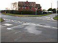
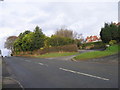

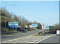

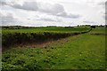


34 photos from this area
Area Information
Key information about the B60 1DF including its size, population, and administrative classification.
- Area Type
- Postcode
- Area Size
- 3.2 hectares
- Population
- 1448
- Population Density
- 1088 people/km²
House Prices in B60 1DF
47
Properties
£278,926
Average Sold Price
£46,250
Lowest Price
£580,000
Highest Price
Showing 47 properties
| Address | Type | Beds | Baths | Last Sale Price | Last Sale Date | |
|---|---|---|---|---|---|---|
| 131A Old Birmingham Road, Lickey End, B60 1DF | Detached | 3 | 1 | £442,000 | Jan 2025 | |
| 101 Old Birmingham Road, Lickey End, B60 1DF | Detached | 4 | 1 | £511,500 | Apr 2024 | |
| 129 Old Birmingham Road, Lickey End, B60 1DF | Semi-detached | 3 | 1 | £445,000 | Mar 2023 | |
| 99 Old Birmingham Road, Lickey End, B60 1DF | Semi-detached | 4 | 2 | £468,000 | Feb 2022 | |
| 81 Old Birmingham Road, Lickey End, B60 1DF | Detached | 3 | 1 | £355,000 | May 2021 | |
| 111A Old Birmingham Road, Lickey End, B60 1DF | Bungalow | - | - | £580,000 | Apr 2021 | |
| 67 Old Birmingham Road, Lickey End, B60 1DF | Detached | 4 | 1 | £380,000 | Oct 2019 | |
| 127 Old Birmingham Road, Lickey End, B60 1DF | Semi-detached | 3 | 1 | £265,000 | Apr 2019 | |
| 87 Old Birmingham Road, Lickey End, B60 1DF | Semi-detached | 3 | 2 | £292,000 | Nov 2018 | |
| 113 Old Birmingham Road, Lickey End, B60 1DF | Semi-detached | 3 | - | £245,000 | Nov 2018 |
Page 1 of 5
Energy Efficiency in B60 1DF
Amenities
Schools
| Rank | School | Type | Entry gender | Ages |
|---|
Explore more schools in this area
Go to Schools tabDemographics
Household Size
Two person
most common
Accommodation Type
Houses
most common
Tenure
93
majority
Ethnic Group
White
most common
Religion
N/A
most common
Household Composition
N/A
most common
Age
47
median
Adults (30-64 years)
most common
Household Deprivation
N/A
with no deprivation
NS-SEC
47
in Lower managerial occupations
Explore more demographic insights in this area
Go to Demographics tabPlanning
Planning Constraints
- Flood RiskPremium
- Ramsar Wetland SitesPremium
- Area of Outstanding Natural BeautyPremium
- Protected Nature ReservePremium
- Protected WoodlandPremium