Area Overview for B6 6RY
Photos of B6 6RY
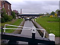
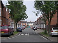
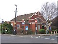
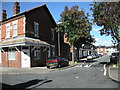
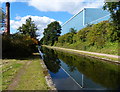
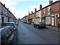

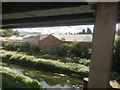
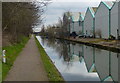
77 photos from this area
Area Information
Key information about the B6 6RY including its size, population, and administrative classification.
- Area Type
- Postcode
- Area Size
- 3385 m²
- Population
- 1295
- Population Density
- 1443 people/km²
House Prices in B6 6RY
28
Properties
£95,287
Average Sold Price
£27,000
Lowest Price
£180,000
Highest Price
Showing 28 properties
| Address | Type | Beds | Baths | Last Sale Price | Last Sale Date | |
|---|---|---|---|---|---|---|
| 22 Charles Road, Perry Barr, Birmingham, B6 6RY | house | - | - | £150,000 | Nov 2025 | |
| 11 Charles Road, Perry Barr, Birmingham, B6 6RY | house | - | - | £180,000 | Jul 2024 | |
| 4 Charles Road, Perry Barr, Birmingham, B6 6RY | house | - | - | £128,000 | Jun 2021 | |
| 13 Charles Road, Perry Barr, Birmingham, B6 6RY | Terraced | 2 | 1 | £140,000 | Dec 2020 | |
| 9 Charles Road, Perry Barr, Birmingham, B6 6RY | house | - | - | £80,000 | Oct 2020 | |
| 23 Charles Road, Perry Barr, Birmingham, B6 6RY | Terraced | 1 | 2 | £120,000 | Mar 2020 | |
| 15 Charles Road, Perry Barr, Birmingham, B6 6RY | Terraced | 3 | 1 | £108,000 | Feb 2019 | |
| 27 Charles Road, Perry Barr, Birmingham, B6 6RY | house | - | - | £59,800 | Sep 2018 | |
| 10 Charles Road, Perry Barr, Birmingham, B6 6RY | Terraced | 2 | 2 | £80,000 | Sep 2017 | |
| 19 Charles Road, Perry Barr, Birmingham, B6 6RY | Terraced | 3 | - | £70,000 | Jun 2014 |
Page 1 of 3
Energy Efficiency in B6 6RY
Amenities
Schools
| Rank | School | Type | Entry gender | Ages |
|---|
Explore more schools in this area
Go to Schools tabDemographics
Household Size
One person
most common
Accommodation Type
Flats
most common
Tenure
27
majority
Ethnic Group
asian_total
most common
Religion
N/A
most common
Household Composition
N/A
most common
Age
22
median
Adults (30-64 years)
most common
Household Deprivation
N/A
with no deprivation
NS-SEC
7
in Lower managerial occupations
Explore more demographic insights in this area
Go to Demographics tabPlanning
Planning Constraints
- Flood RiskPremium
- Ramsar Wetland SitesPremium
- Area of Outstanding Natural BeautyPremium
- Protected Nature ReservePremium
- Protected WoodlandPremium