Area Overview for B6 6DE
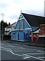
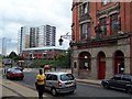
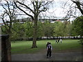
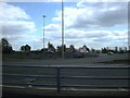
Photos of B6 6DE


Area Information
The B6 6DE postcode covers a small residential cluster in Aston, an urban ward in north-east Birmingham. This distinct area stands out for its deep historical roots and its position at the heart of the city's road network. It was first mentioned in the Domesday Book in 1086 as an ancient parish known as Aston juxta Birmingham. The ward was formally incorporated into Birmingham in 1911 after the annexation of the Aston Manor Urban District. Today, the area encompasses approximately 1578 square metres of residential space. A population of 1884 lives within this compact boundary. Living in B6 6DE involves navigating a environment shaped by early 20th-century industry, including the former Premier Motor Works, and significant regeneration projects like Aston Pride between 2001 and 2011. You will find yourself surrounded by late 19th- and early 20th-century terraced housing, some of which remains intact despite roadworks like the 1960s Aston Expressway construction. The area sits near AB Row, which historically separated Aston from the rest of Birmingham, and offers proximity to the infamous Spaghetti Junction. Daily life here is defined by its location at the junction of major routes such as Lichfield Road and Walsall Road. The physical size of the postcode is small, yet it serves as a critical node connecting residents to the wider West Midlands region.
- Area Type
- Postcode
- Area Size
- 1578 m²
- Population
- 1884
- Population Density
- 14126 people/km²
Understanding the property market in B6 6DE requires looking at the specific composition of the housing stock. You will primarily find houses rather than flats or maisonettes within this postcode boundary. This residential character aligns with the ward's historical development from the early 20th century, which favoured detached and semi-detached family homes before later urban expansion. A significant 60% of residents own their homes outright or have a mortgage, suggesting a market where ownership is more common than renting. This statistic indicates that the area appeals to those seeking stability and long-term security rather than short-term lets. For buyers looking at homes in B6 6DE, the environment offers a traditional suburban feel within an urban setting due to the prevalence of houses. The small size of the area, covering just 1578 square metres, means that property options are limited and specific to this cluster. The high home ownership rate often correlates with established neighbourhoods where families have stay put over generations. Potential buyers should note that the accommodation type is exclusively houses, which may rule out candidates specifically seeking flat living arrangements. The market reflects a stable, owner-led community.
House Prices in B6 6DE
Showing 8 properties
| Address | Type | Beds | Baths | Last Sale Price | Last Sale Date | |
|---|---|---|---|---|---|---|
| 256 Frederick Road, Aston, Birmingham, B6 6DE | Terraced | - | - | £160,000 | Jul 2019 | |
| 262 Frederick Road, Aston, Birmingham, B6 6DE | Terraced | 4 | - | £125,000 | Feb 2017 | |
| 260 Frederick Road, Aston, Birmingham, B6 6DE | house | - | - | £140,000 | Jul 2005 | |
| 258 Frederick Road, Aston, Birmingham, B6 6DE | house | 4 | - | £79,500 | Oct 2001 | |
| 254 Frederick Road, Aston, Birmingham, B6 6DE | Terraced | - | - | - | - | |
| 250 Frederick Road, Aston, Birmingham, B6 6DE | Terraced | - | - | - | - | |
| 252A Frederick Road, Aston, Birmingham, B6 6DE | Flat | - | - | - | - | |
| 252B Frederick Road, Aston, Birmingham, B6 6DE | Flat | - | - | - | - |
Energy Efficiency in B6 6DE
Your lifestyle in B6 6DE benefits from ultra-convenient access to major retail and transport hubs. Five notable retail locations operate within practical reach of your home, providing daily shopping convenience. You will find Aldi Aston, Tesco Aston, and Morrisons Select available for your weekly groceries and essentials. Retail offerings are backed by five railway stations and five metro stops nearby, ensuring easy access to further destinations. Proximity to Witton, Perry Barr, and Aston Railway Stations means you can access a wider network without straying far from the postcode boundary. For those who prefer the underground, St Paul's, St Chads, and Bull Street stations are just a short trip away. This concentration of amenities means your daily runs are quick and efficient. The area supports a mix of commercial and residential needs within a tight radius. You do not need to travel far to find what you need, which saves time and money. The presence of three Stevenage stations in the nearby transport list indicates a robust link to regional employment and leisure centres. Shopping, commuting, and travelling are all integrated into a seamless routine for residents.
Amenities
Schools
Families considering schools near B6 6DE have access to a variety of educational institutions. The nearest options include Prince Albert Junior and Infant School, which serves younger children in the primary sector. You will also find Mansfield Green Community School nearby, another primary institution suitable for younger pupils. For secondary-aged children, Mansfield Green E-ACT Academy offers education with an outstanding Ofsted rating. This exceptional rating highlights a high standard of teaching and performance in the area. Titan St Georges Academy and Kajans Hospitality & Catering Studio College are also listed as nearby educational providers serving the local catchment. The presence of an academy with outstanding status is a strong indicator for prospective residents. The mix of primary schools, academies, and specialist colleges provides a comprehensive range of choices. Students can progress through different levels of education within a tight geographical radius. The variety extends from early years provision up through secondary and technical training. This educational infrastructure supports both families with young children and older students seeking vocational or academic pathways.
| Rank | School | Type | Entry gender | Ages |
|---|
Explore more schools in this area
Go to Schools tabDemographics
The community in B6 6DE is defined by a young and diverse demographic profile. The median age for residents is 22 years old, indicating a population skewed significantly towards the younger end of the scale. Although the specific range listed as most common is adults aged 30 to 64 years, the low median age suggests a large cohort of university students or recent graduates also resides here. House ownership stands at a solid 60%, meaning the majority of homes are owner-occupied rather than part of the private rental sector. Houses form the predominant accommodation type within this specific postcode, contrasting with the high-rise blocks often found in other parts of inner-city Birmingham. Diversity is a defining feature of the neighbourhood, with Asian groups forming the predominant ethnic community. This reflects the area's history of immigration from the Indian subcontinent since the 1950s and 1960s. The population density is extremely high at 1193633 people per square kilometre, which is an exceptionally dense figure for any region. You will find yourself living among a tightly knit community where neighbours often interact frequently due to the crowded nature of the housing stock. The area manages to balance older demographic anchors with a vibrant youth presence.
Household Size
Accommodation Type
Tenure
Ethnic Group
Religion
Household Composition
Age
Household Deprivation
NS-SEC
Explore more demographic insights in this area
Go to Demographics tabPlanning
Planning Constraints
- Flood RiskPremium
- Ramsar Wetland SitesPremium
- Area of Outstanding Natural BeautyPremium
- Protected Nature ReservePremium
- Protected WoodlandPremium