Area Overview for B50 4NT
Photos of B50 4NT
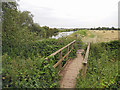
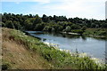
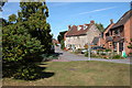
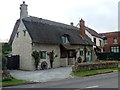
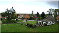
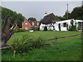
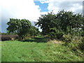
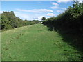
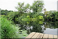
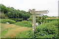
32 photos from this area
Area Information
Key information about the B50 4NT including its size, population, and administrative classification.
- Area Type
- Postcode
- Area Size
- 53.1 hectares
- Population
- 2424
- Population Density
- 262 people/km²
House Prices in B50 4NT
26
Properties
£302,371
Average Sold Price
£61,500
Lowest Price
£775,000
Highest Price
Showing 26 properties
| Address | Type | Beds | Baths | Last Sale Price | Last Sale Date | |
|---|---|---|---|---|---|---|
| 22 The Bank, Marlcliff, Bidford On Avon, B50 4NT | Detached | 1 | 1 | £150,000 | Dec 2024 | |
| Cosy Cottage, 12 The Bank, Marlcliff, Bidford On Avon, B50 4NT | Semi-detached | 2 | 1 | £267,000 | May 2024 | |
| Mulberry Cottage, 11 The Bank, Marlcliff, Bidford On Avon, B50 4NT | Detached | 4 | 1 | £775,000 | Dec 2022 | |
| 18 The Bank, Marlcliff, Bidford On Avon, B50 4NT | Semi-detached | 1 | 1 | £199,950 | Jun 2022 | |
| Woodpeckers, The Bank, Marlcliff, Bidford On Avon, B50 4NT | Detached | 4 | 1 | £615,000 | Jun 2019 | |
| 10 The Bank, Marlcliff, Bidford On Avon, B50 4NT | house | - | - | £170,000 | Dec 2018 | |
| 2 The Bank, Marlcliff, Bidford On Avon, B50 4NT | Semi-detached | 4 | 1 | £310,000 | Oct 2017 | |
| 16 The Bank, Marlcliff, Bidford On Avon, B50 4NT | house | 2 | - | £217,000 | May 2015 | |
| 24 The Bank, Marlcliff, Bidford On Avon, B50 4NT | Semi-detached | 4 | 1 | £590,000 | Sep 2011 | |
| 14 The Bank, Marlcliff, Bidford On Avon, B50 4NT | house | 2 | - | £177,000 | Apr 2007 |
Page 1 of 3
Energy Efficiency in B50 4NT
Amenities
Schools
| Rank | School | Type | Entry gender | Ages |
|---|
Explore more schools in this area
Go to Schools tabDemographics
Household Size
Two person
most common
Accommodation Type
Houses
most common
Tenure
76
majority
Ethnic Group
White
most common
Religion
N/A
most common
Household Composition
N/A
most common
Age
47
median
Adults (30-64 years)
most common
Household Deprivation
N/A
with no deprivation
NS-SEC
39
in Lower managerial occupations
Explore more demographic insights in this area
Go to Demographics tabPlanning
Planning Constraints
- Flood RiskPremium
- Ramsar Wetland SitesPremium
- Area of Outstanding Natural BeautyPremium
- Protected Nature ReservePremium
- Protected WoodlandPremium