Area Overview for B50 4GS
Photos of B50 4GS
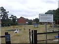
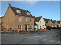
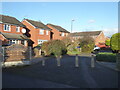
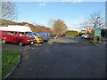
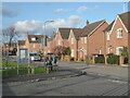
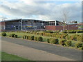
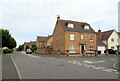
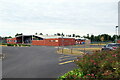
28 photos from this area
Area Information
Key information about the B50 4GS including its size, population, and administrative classification.
- Area Type
- Postcode
- Area Size
- 9946 m²
- Population
- 2070
- Population Density
- 511 people/km²
House Prices in B50 4GS
27
Properties
£370,729
Average Sold Price
£150,000
Lowest Price
£509,995
Highest Price
Showing 27 properties
| Address | Type | Beds | Baths | Last Sale Price | Last Sale Date | |
|---|---|---|---|---|---|---|
| 25 Spearhead Road, Bidford On Avon, B50 4GS | house | 5 | 3 | £462,500 | Feb 2025 | |
| 17 Spearhead Road, Bidford On Avon, B50 4GS | Retail | 4 | 2 | £150,000 | May 2022 | |
| 35 Spearhead Road, Bidford On Avon, B50 4GS | house | - | - | £443,000 | Mar 2022 | |
| 1 Spearhead Road, Bidford On Avon, B50 4GS | Detached | 5 | 3 | £445,000 | Feb 2021 | |
| 49 Spearhead Road, Bidford On Avon, B50 4GS | Bungalow | - | - | £269,995 | Aug 2020 | |
| 55 Spearhead Road, Bidford On Avon, B50 4GS | house | - | - | £509,995 | Jul 2020 | |
| 53 Spearhead Road, Bidford On Avon, B50 4GS | house | - | - | £458,000 | Jul 2020 | |
| 51 Spearhead Road, Bidford On Avon, B50 4GS | house | - | - | £399,995 | Jun 2020 | |
| 45 Spearhead Road, Bidford On Avon, B50 4GS | house | - | - | £316,068 | Dec 2019 | |
| 23 Spearhead Road, Bidford On Avon, B50 4GS | Detached | 3 | - | £415,000 | Jun 2019 |
Page 1 of 3
Energy Efficiency in B50 4GS
Amenities
Schools
| Rank | School | Type | Entry gender | Ages |
|---|
Explore more schools in this area
Go to Schools tabDemographics
Household Size
Two person
most common
Accommodation Type
Houses
most common
Tenure
83
majority
Ethnic Group
White
most common
Religion
N/A
most common
Household Composition
N/A
most common
Age
47
median
Adults (30-64 years)
most common
Household Deprivation
N/A
with no deprivation
NS-SEC
43
in Lower managerial occupations
Explore more demographic insights in this area
Go to Demographics tabPlanning
Planning Constraints
- Flood RiskPremium
- Ramsar Wetland SitesPremium
- Area of Outstanding Natural BeautyPremium
- Protected Nature ReservePremium
- Protected WoodlandPremium