Area Overview for B49 6EQ
Photos of B49 6EQ
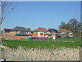
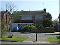
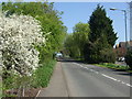
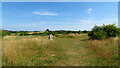
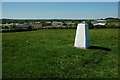
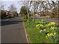
19 photos from this area
Area Information
Key information about the B49 6EQ including its size, population, and administrative classification.
- Area Type
- Postcode
- Area Size
- 4118 m²
- Population
- 2398
- Population Density
- 169 people/km²
House Prices in B49 6EQ
14
Properties
£155,278
Average Sold Price
£80,000
Lowest Price
£215,000
Highest Price
Showing 14 properties
| Address | Type | Beds | Baths | Last Sale Price | Last Sale Date | |
|---|---|---|---|---|---|---|
| 15 Purton Close, Alcester, B49 6EQ | house | - | - | £148,500 | Mar 2022 | |
| 6 Purton Close, Alcester, B49 6EQ | Terraced | - | - | £212,000 | Jul 2021 | |
| 8 Purton Close, Alcester, B49 6EQ | Semi-detached | 2 | 1 | £215,000 | Apr 2021 | |
| 4 Purton Close, Alcester, B49 6EQ | house | - | - | £145,000 | Mar 2020 | |
| 7 Purton Close, Alcester, B49 6EQ | Terraced | 2 | - | £145,000 | Aug 2014 | |
| 10 Purton Close, Alcester, B49 6EQ | house | - | - | £157,500 | Sep 2013 | |
| 9 Purton Close, Alcester, B49 6EQ | Terraced | 2 | 1 | £140,000 | Jul 2010 | |
| 5 Purton Close, Alcester, B49 6EQ | house | - | - | £154,500 | May 2007 | |
| 1 Purton Close, Alcester, B49 6EQ | Terraced | - | - | £80,000 | May 2002 | |
| 12 Purton Close, Alcester, B49 6EQ | Semi-detached | - | - | - | - |
Page 1 of 2
Energy Efficiency in B49 6EQ
Amenities
Schools
| Rank | School | Type | Entry gender | Ages |
|---|
Explore more schools in this area
Go to Schools tabDemographics
Household Size
Two person
most common
Accommodation Type
Houses
most common
Tenure
82
majority
Ethnic Group
White
most common
Religion
N/A
most common
Household Composition
N/A
most common
Age
47
median
Adults (30-64 years)
most common
Household Deprivation
N/A
with no deprivation
NS-SEC
42
in Lower managerial occupations
Explore more demographic insights in this area
Go to Demographics tabPlanning
Planning Constraints
- Flood RiskPremium
- Ramsar Wetland SitesPremium
- Area of Outstanding Natural BeautyPremium
- Protected Nature ReservePremium
- Protected WoodlandPremium