Area Overview for B49 6AU
Photos of B49 6AU
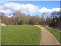
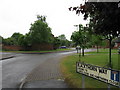
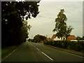
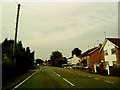
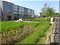
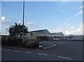
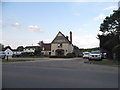
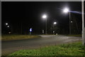
32 photos from this area
Area Information
Key information about the B49 6AU including its size, population, and administrative classification.
- Area Type
- Postcode
- Area Size
- 2.5 hectares
- Population
- 1321
- Population Density
- 3043 people/km²
House Prices in B49 6AU
41
Properties
£164,139
Average Sold Price
£35,000
Lowest Price
£287,500
Highest Price
Showing 41 properties
| Address | Type | Beds | Baths | Last Sale Price | Last Sale Date | |
|---|---|---|---|---|---|---|
| 7 Vallet Avenue, Alcester, B49 6AU | Terraced | 4 | 1 | £287,500 | Jun 2023 | |
| 1 Vallet Avenue, Alcester, B49 6AU | house | 3 | 1 | £230,000 | Mar 2022 | |
| 12 Vallet Avenue, Alcester, B49 6AU | house | 2 | 1 | £210,000 | Dec 2021 | |
| 34 Vallet Avenue, Alcester, B49 6AU | house | - | - | £200,000 | Oct 2019 | |
| 31 Vallet Avenue, Alcester, B49 6AU | Terraced | 4 | 1 | £210,000 | Oct 2019 | |
| 28 Vallet Avenue, Alcester, B49 6AU | Terraced | 3 | 1 | £182,000 | Feb 2018 | |
| 25 Vallet Avenue, Alcester, B49 6AU | Terraced | 2 | 1 | £133,000 | Aug 2015 | |
| 5 Vallet Avenue, Alcester, B49 6AU | house | - | - | £159,950 | Jul 2010 | |
| 24 Vallet Avenue, Alcester, B49 6AU | Terraced | - | - | £156,000 | Nov 2007 | |
| 29 Vallet Avenue, Alcester, B49 6AU | house | - | - | £154,500 | May 2007 |
Page 1 of 5
Energy Efficiency in B49 6AU
Amenities
Schools
| Rank | School | Type | Entry gender | Ages |
|---|
Explore more schools in this area
Go to Schools tabDemographics
Household Size
Two person
most common
Accommodation Type
Houses
most common
Tenure
48
majority
Ethnic Group
White
most common
Religion
N/A
most common
Household Composition
N/A
most common
Age
47
median
Adults (30-64 years)
most common
Household Deprivation
N/A
with no deprivation
NS-SEC
23
in Lower managerial occupations
Explore more demographic insights in this area
Go to Demographics tabPlanning
Planning Constraints
- Flood RiskPremium
- Ramsar Wetland SitesPremium
- Area of Outstanding Natural BeautyPremium
- Protected Nature ReservePremium
- Protected WoodlandPremium