Area Overview for B49 6AH
Photos of B49 6AH
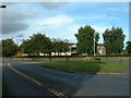
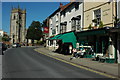
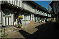
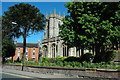

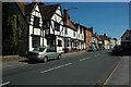
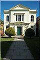
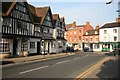
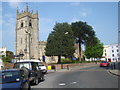

100 photos from this area
Area Information
Key information about the B49 6AH including its size, population, and administrative classification.
- Area Type
- Postcode
- Area Size
- 6241 m²
- Population
- 1321
- Population Density
- 3043 people/km²
House Prices in B49 6AH
17
Properties
£98,600
Average Sold Price
£37,500
Lowest Price
£189,950
Highest Price
Showing 17 properties
| Address | Type | Beds | Baths | Last Sale Price | Last Sale Date | |
|---|---|---|---|---|---|---|
| 27 Gunnings Road, Alcester, B49 6AH | Flat | 1 | 1 | £72,500 | Apr 2024 | |
| 33 Gunnings Road, Alcester, B49 6AH | Flat | - | - | £100,000 | Aug 2021 | |
| 37 Gunnings Road, Alcester, B49 6AH | Flat | - | - | £100,000 | Aug 2019 | |
| 35 Gunnings Road, Alcester, B49 6AH | Maisonette | 1 | 1 | £110,000 | Sep 2018 | |
| 31 Gunnings Road, Alcester, B49 6AH | Flat | 1 | 1 | £112,500 | Aug 2018 | |
| 21 Gunnings Road, Alcester, B49 6AH | Flat | 1 | 1 | £105,000 | Aug 2017 | |
| 11 Gunnings Road, Alcester, B49 6AH | Maisonette | 1 | 1 | £104,000 | Aug 2017 | |
| 9 Gunnings Road, Alcester, B49 6AH | Flat | 1 | 1 | £94,000 | Dec 2016 | |
| 7 Gunnings Road, Alcester, B49 6AH | Flat | - | - | £77,000 | May 2013 | |
| 17 Gunnings Road, Alcester, B49 6AH | Flat | 1 | - | £88,000 | Oct 2010 |
Page 1 of 2
Energy Efficiency in B49 6AH
Amenities
Schools
| Rank | School | Type | Entry gender | Ages |
|---|
Explore more schools in this area
Go to Schools tabDemographics
Household Size
Two person
most common
Accommodation Type
Houses
most common
Tenure
48
majority
Ethnic Group
White
most common
Religion
N/A
most common
Household Composition
N/A
most common
Age
47
median
Adults (30-64 years)
most common
Household Deprivation
N/A
with no deprivation
NS-SEC
23
in Lower managerial occupations
Explore more demographic insights in this area
Go to Demographics tabPlanning
Planning Constraints
- Flood RiskPremium
- Ramsar Wetland SitesPremium
- Area of Outstanding Natural BeautyPremium
- Protected Nature ReservePremium
- Protected WoodlandPremium