Area Overview for B49 5NX
Photos of B49 5NX
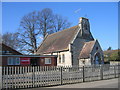

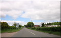
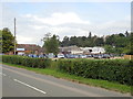
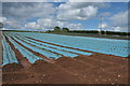
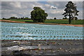
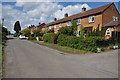
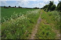
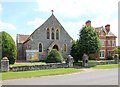
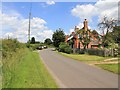
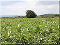
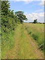
33 photos from this area
Area Information
Key information about the B49 5NX including its size, population, and administrative classification.
- Area Type
- Postcode
- Area Size
- 9.0 hectares
- Population
- 1746
- Population Density
- 91 people/km²
House Prices in B49 5NX
21
Properties
£311,040
Average Sold Price
£156,250
Lowest Price
£612,000
Highest Price
Showing 21 properties
| Address | Type | Beds | Baths | Last Sale Price | Last Sale Date | |
|---|---|---|---|---|---|---|
| The Old Bakehouse, Dunnington Road, Dunnington, Salford Priors, B49 5NX | Semi-detached | 4 | 2 | £612,000 | Mar 2025 | |
| Little Ragley, Dunnington Road, Dunnington, Salford Priors, B49 5NX | house | - | - | £330,000 | Nov 2022 | |
| Beech Cottage, Dunnington Road, Dunnington, Salford Priors, B49 5NX | house | - | - | £207,000 | Jan 2022 | |
| Honeysuckle Cottage, Dunnington Road, Dunnington, Salford Priors, B49 5NX | house | 3 | - | £156,250 | Feb 2000 | |
| Orchard House, 44 Dunnington Road, Dunnington, Salford Priors, B49 5NX | Detached | - | - | £249,950 | Dec 1999 | |
| 48 Dunnington Road, Dunnington, Salford Priors, B49 5NX | house | 3 | 1 | - | - | |
| 39E, Rivendell, Chapel Yard, Dunnington Road, Dunnington, Salford Priors, B49 5NX | Detached | 4 | 2 | - | - | |
| 39D, Chapel Yard, Dunnington Road, Dunnington, Salford Priors, B49 5NX | Detached | - | - | - | - | |
| 39, Hawthorne Cottage, Chapel Yard, Dunnington Road, Dunnington, Salford Priors, B49 5NX | house | - | - | - | - | |
| Conway Cottage, Dunnington Road, Dunnington, Salford Priors, B49 5NX | Detached | - | - | - | - |
Page 1 of 3
Energy Efficiency in B49 5NX
Amenities
Schools
| Rank | School | Type | Entry gender | Ages |
|---|
Explore more schools in this area
Go to Schools tabDemographics
Household Size
Two person
most common
Accommodation Type
Houses
most common
Tenure
70
majority
Ethnic Group
White
most common
Religion
N/A
most common
Household Composition
N/A
most common
Age
47
median
Adults (30-64 years)
most common
Household Deprivation
N/A
with no deprivation
NS-SEC
36
in Lower managerial occupations
Explore more demographic insights in this area
Go to Demographics tabPlanning
Planning Constraints
- Flood RiskPremium
- Ramsar Wetland SitesPremium
- Area of Outstanding Natural BeautyPremium
- Protected Nature ReservePremium
- Protected WoodlandPremium