Area Overview for B49 5EE
Photos of B49 5EE
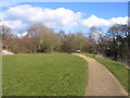
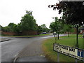
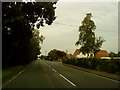
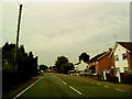
32 photos from this area
Area Information
Key information about the B49 5EE including its size, population, and administrative classification.
- Area Type
- Postcode
- Area Size
- 1.8 hectares
- Population
- 1431
- Population Density
- 225 people/km²
House Prices in B49 5EE
21
Properties
£229,681
Average Sold Price
£90,000
Lowest Price
£395,000
Highest Price
Showing 21 properties
| Address | Type | Beds | Baths | Last Sale Price | Last Sale Date | |
|---|---|---|---|---|---|---|
| 45 Birmingham Road, Alcester, B49 5EE | Terraced | 3 | 1 | £293,000 | Feb 2024 | |
| 25 Birmingham Road, Alcester, B49 5EE | Terraced | 4 | 2 | £195,000 | Aug 2021 | |
| 53 Birmingham Road, Alcester, B49 5EE | Semi-detached | 4 | 3 | £395,000 | Jan 2021 | |
| 37 Birmingham Road, Alcester, B49 5EE | Semi-detached | 3 | 1 | £290,000 | Oct 2018 | |
| 31 Birmingham Road, Alcester, B49 5EE | Semi-detached | - | - | £233,000 | Aug 2007 | |
| 15 Birmingham Road, Ragley Mill Lane, Alcester, B49 5EE | house | - | - | £151,500 | Jun 2005 | |
| 33 Birmingham Road, Alcester, B49 5EE | Semi-detached | - | - | £189,950 | Mar 2004 | |
| 35 Birmingham Road, Alcester, B49 5EE | Semi-detached | - | - | £90,000 | Oct 2001 | |
| 27 Birmingham Road, Alcester, B49 5EE | house | 3 | 1 | - | - | |
| 41 Birmingham Road, Alcester, B49 5EE | house | - | - | - | - |
Page 1 of 3
Energy Efficiency in B49 5EE
Amenities
Schools
| Rank | School | Type | Entry gender | Ages |
|---|
Explore more schools in this area
Go to Schools tabDemographics
Household Size
Two person
most common
Accommodation Type
Houses
most common
Tenure
78
majority
Ethnic Group
White
most common
Religion
N/A
most common
Household Composition
N/A
most common
Age
47
median
Adults (30-64 years)
most common
Household Deprivation
N/A
with no deprivation
NS-SEC
44
in Lower managerial occupations
Explore more demographic insights in this area
Go to Demographics tabPlanning
Planning Constraints
- Flood RiskPremium
- Ramsar Wetland SitesPremium
- Area of Outstanding Natural BeautyPremium
- Protected Nature ReservePremium
- Protected WoodlandPremium