Area Overview for B48 7HE
Photos of B48 7HE
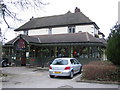
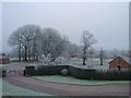
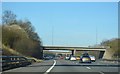
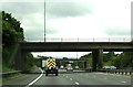


31 photos from this area
Area Information
Key information about the B48 7HE including its size, population, and administrative classification.
- Area Type
- Postcode
- Area Size
- 21.8 hectares
- Population
- 1567
- Population Density
- 82 people/km²
House Prices in B48 7HE
11
Properties
£392,667
Average Sold Price
£278,000
Lowest Price
£575,000
Highest Price
Showing 11 properties
| Address | Type | Beds | Baths | Last Sale Price | Last Sale Date | |
|---|---|---|---|---|---|---|
| Peacocks, Billesley Lane, Portway, B48 7HE | Detached | 6 | 3 | £575,000 | Jun 2016 | |
| 1, Newland Cottage, Billesley Lane, Portway, B48 7HE | house | - | - | £325,000 | May 2011 | |
| 2, Newland Cottage, Billesley Lane, Portway, B48 7HE | Semi-detached | - | - | £278,000 | Aug 2008 | |
| Newlands Barn, Billesley Lane, Portway, B48 7HE | Semi-detached | 5 | 2 | - | - | |
| The Lodge, Newlands Barns, Billesley Lane, Portway, B48 7HE | Semi-detached | 4 | 2 | - | - | |
| The Old Stables, Billesley Lane, Portway, B48 7HE | Semi-detached | 6 | 2 | - | - | |
| Pool Close, Billesley Lane, Portway, B48 7HE | Detached | 5 | - | - | - | |
| Patten House, Billesley Lane, Portway, B48 7HE | Unknown | - | - | - | - | |
| Twin Oaks Farm House, Billesley Lane, Portway, B48 7HE | Detached | - | - | - | - | |
| Newlands Granary, Newlands Barn, Billesley Lane, Portway, B48 7HE | Bungalow | - | - | - | - |
Page 1 of 2
Energy Efficiency in B48 7HE
Amenities
Schools
| Rank | School | Type | Entry gender | Ages |
|---|
Explore more schools in this area
Go to Schools tabDemographics
Household Size
Two person
most common
Accommodation Type
Houses
most common
Tenure
89
majority
Ethnic Group
White
most common
Religion
N/A
most common
Household Composition
N/A
most common
Age
47
median
Adults (30-64 years)
most common
Household Deprivation
N/A
with no deprivation
NS-SEC
44
in Lower managerial occupations
Explore more demographic insights in this area
Go to Demographics tabPlanning
Planning Constraints
- Flood RiskPremium
- Ramsar Wetland SitesPremium
- Area of Outstanding Natural BeautyPremium
- Protected Nature ReservePremium
- Protected WoodlandPremium