Area Overview for B48 7DD
Photos of B48 7DD
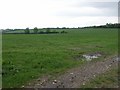
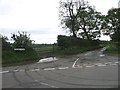
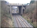
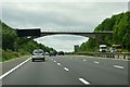


16 photos from this area
Area Information
Key information about the B48 7DD including its size, population, and administrative classification.
- Area Type
- Postcode
- Area Size
- 42.9 hectares
- Population
- 1137
- Population Density
- 43 people/km²
House Prices in B48 7DD
11
Properties
£532,088
Average Sold Price
£279,500
Lowest Price
£839,000
Highest Price
Showing 11 properties
| Address | Type | Beds | Baths | Last Sale Price | Last Sale Date | |
|---|---|---|---|---|---|---|
| Gorsey Lane Cottage, Wheeley Road, Blackwell, B48 7DD | house | - | - | £839,000 | Mar 2021 | |
| Granary Cottage, Wheeley Road, Blackwell, B48 7DD | house | - | - | £439,850 | Jul 2015 | |
| Hob Cottage, Wheeley Road, Blackwell, B48 7DD | Terraced | - | - | £279,500 | Jun 2003 | |
| Wheeley House, Wheeley Road, Blackwell, B48 7DD | Detached | - | - | £570,000 | Jun 2002 | |
| Holly Grange, Wheeley Road, Blackwell, B48 7DD | Detached | 5 | - | - | - | |
| Ambient Air Conditioning Ltd, 5-6, Wheeley Ridge, Wheeley Road, Blackwell, B48 7DD | office_workshop | - | - | - | - | |
| Ryder Construction Ltd, Wheeley Ridge, Wheeley Road, Blackwell, B48 7DD | Office | - | - | - | - | |
| 8, Wheeley Ridge, Wheeley Road, Blackwell, B48 7DD | Office | - | - | - | - | |
| Room Two Three And First Floor, Wheeley Ridge, Wheeley Road, Blackwell, B48 7DD | office_workshop | - | - | - | - | |
| Room 4, Halfway Oak Barn, Wheeley Road, Blackwell, B48 7DD | Office | - | - | - | - |
Page 1 of 2
Energy Efficiency in B48 7DD
Amenities
Schools
| Rank | School | Type | Entry gender | Ages |
|---|
Explore more schools in this area
Go to Schools tabDemographics
Household Size
Two person
most common
Accommodation Type
Houses
most common
Tenure
85
majority
Ethnic Group
White
most common
Religion
N/A
most common
Household Composition
N/A
most common
Age
47
median
Adults (30-64 years)
most common
Household Deprivation
N/A
with no deprivation
NS-SEC
46
in Lower managerial occupations
Explore more demographic insights in this area
Go to Demographics tabPlanning
Planning Constraints
- Flood RiskPremium
- Ramsar Wetland SitesPremium
- Area of Outstanding Natural BeautyPremium
- Protected Nature ReservePremium
- Protected WoodlandPremium