Area Overview for B48 7AY
Photos of B48 7AY
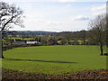
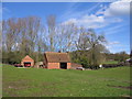
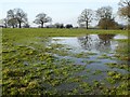
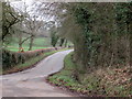
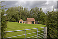


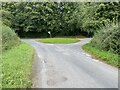
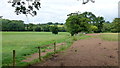
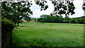


17 photos from this area
Area Information
Key information about the B48 7AY including its size, population, and administrative classification.
- Area Type
- Postcode
- Area Size
- 37.8 hectares
- Population
- 2310
- Population Density
- 139 people/km²
House Prices in B48 7AY
15
Properties
£509,707
Average Sold Price
£123,000
Lowest Price
£1,050,000
Highest Price
Showing 15 properties
| Address | Type | Beds | Baths | Last Sale Price | Last Sale Date | |
|---|---|---|---|---|---|---|
| 7, Lea End House, Lea End Lane, Hopwood, B48 7AY | Semi-detached | 3 | - | £675,000 | Jun 2021 | |
| 2, Lea End House, Lea End Lane, Hopwood, B48 7AY | house | - | - | £600,000 | Jun 2021 | |
| Lynwood Barns, Lea End Lane, Hopwood, B48 7AY | Semi-detached | 5 | 4 | £1,050,000 | Oct 2020 | |
| Meadow Bank, Lea End Lane, Hopwood, B48 7AY | house | 2 | - | £335,000 | Aug 2018 | |
| 3, Lea End House, Lea End Lane, Hopwood, B48 7AY | Semi-detached | 4 | 2 | £435,000 | Jan 2016 | |
| 1, Lea End House, Lea End Lane, Hopwood, B48 7AY | house | - | - | £349,950 | Jun 2014 | |
| 2, Lea End Cottages, Lea End Lane, Hopwood, B48 7AY | Semi-detached | - | - | £123,000 | Nov 2001 | |
| Lynwood House, Lea End Lane, Hopwood, B48 7AY | Semi-detached | 5 | 4 | - | - | |
| 4, Oak Tree Barn, Lea End House, Lea End Lane, Hopwood, B48 7AY | Semi-detached | 4 | 2 | - | - | |
| 8, The Byre, Lea End House, Lea End Lane, Hopwood, B48 7AY | Retail | 3 | 3 | - | - |
Page 1 of 2
Energy Efficiency in B48 7AY
Amenities
Schools
| Rank | School | Type | Entry gender | Ages |
|---|
Explore more schools in this area
Go to Schools tabDemographics
Household Size
Family (3-5 people)
most common
Accommodation Type
Houses
most common
Tenure
83
majority
Ethnic Group
White
most common
Religion
N/A
most common
Household Composition
N/A
most common
Age
47
median
Adults (30-64 years)
most common
Household Deprivation
N/A
with no deprivation
NS-SEC
45
in Lower managerial occupations
Explore more demographic insights in this area
Go to Demographics tabPlanning
Planning Constraints
- Flood RiskPremium
- Ramsar Wetland SitesPremium
- Area of Outstanding Natural BeautyPremium
- Protected Nature ReservePremium
- Protected WoodlandPremium