Area Overview for B47 6WG
Photos of B47 6WG


Area Information
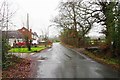
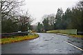
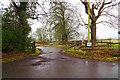
Living in B47 6WG means residing within a specific residential cluster defined by the postcode B47 6WG. This location in Worcestershire occupies an area of 7.4 hectares and supports a population of 1,215 residents. The designations suggest a tightly knit community rather than a sprawling urban district. The area sits within the context of Wythall, a larger village nearby with its own distinct civil parish status. You are living in a environment where daily life revolves around a small, defined footprint. The proximity to Key urban centres like Birmingham provides practical access to wider amenities while maintaining aresidential character. The small area size indicates close proximity between homes and local facilities. Residents here enjoy a setting that balances village convenience with the proximity to major transport links in the West Midlands. The community benefits from a location near the headwaters of the River Cole. This setting offers a distinct local identity separate from the bustling city centre while remaining well-connected to it.
- Area Type
- Postcode
- Area Size
- 7.4 hectares
- Population
- 1215
- Population Density
- 221 people/km²
The property market in B47 6WG is characterised by a dominant owner-occupied sector. At the postcode site, 95 per cent of dwellings are owned outright or with a mortgage. Only five per cent of the 1,215 residents are likely to be tenants. Houses form the standard accommodation type across this 7.4 hectare cluster. This high concentration of freehold homes creates a market environment distinct from typical city-centre rental districts. Buyers looking at this specific postcode will find a stock geared towards long-term settlement. The lack of rental housing suggests limited investment properties or short-term lets within the immediate boundaries. This stability often correlates with slower property price fluctuations compared to high-turnover rental areas. Families seeking to buy a home to settle into a house for years or decades will find the inventory suitable. The small cluster size limits the volume of available properties for an open market. You are entering a market defined by permanence and established tenure rather than speculation.
House Prices in B47 6WG
Showing 2 properties
| Address | Type | Beds | Baths | Last Sale Price | Last Sale Date | |
|---|---|---|---|---|---|---|
| Tennis 191M From Pearl Group, 1 Wythall Green Way 26M From Unnamed Road, Wythall Green Way, Wythall, B47 6WG | Leisure | - | - | - | - | |
| Cafe De Wheels, Mobile Cafe, Middle Lane, Wythall, B47 6WG | Restaurant | - | - | - | - |
Energy Efficiency in B47 6WG
Residents of B47 6WG benefit from a practical range of amenities within practical reach. Five retail outlets are located nearby, including Spar, Tesco Birmingham, and Sainsburys Maypole. These specific supermarkets handle daily grocery needs without requiring a significant journey. A total of five railway stations are listed as accessible points, providing strong public transport links. Wythall Railway Station, Earlswood Railway Station, and Whitlocks End Railway Station offer regular connections to the wider network. The presence of these specific facilities ensures you can access both routine shopping and national rail travel from this postcode. The combination of local supermarkets and rail access defines the daily convenience of the area. You do not need to drive for essential shopping or commuting. The location places you close to established high street offerings while remaining in a residential setting. All listed amenities are confirmed in the available data.
Amenities
Schools
Families looking at B47 6WG have access to proven educational institutions nearby. Meadow Green Primary School operates as a primary school serving the surrounding community. The school holds a good Ofsted rating, which provides assurance on educational standards. This is the only primary school listed in the data for the immediate vicinity. As a primary facility, it ensures young children receive local education without long commutes to secondary sites. The absence of listed secondary schools in the immediate data suggests families may rely on catchment areas beyond the immediate postcode. The existence of a rated primary school supports the view that this area hosts younger families alongside the older demographic. Parents can be confident that a child will have access to a recognised primary education. The reliable performance of the school adds practical value to the residential environment for those with school-age children.
| Rank | School | Type | Entry gender | Ages |
|---|
Explore more schools in this area
Go to Schools tabDemographics
The community in B47 6WG reflects a settled population with a median age of 47 years. Most residents fall within the 30 to 64 years age range, indicating a dominant group of working-age adults. This demographic profile suggests stability rather than a transient student or young professional scene. Home ownership stands at an exceptionally high level of 95 per cent within this postcode cluster. This statistic confirms the area is overwhelmingly occupied by those who have purchased their properties. Houses constitute the primary accommodation type for the 1,215 residents. The most common ethnic group is White, consistent with the established residential nature of the location. With such a high ownership rate, the area functions as a retirement or family retention zone. There is very little private renting activity compared to other urban postcodes. The low diversity in ethnic makeup aligns with similar surrounding areas that have long-standing residential history. A move here places you among established homeowners rather than first-time renters.
Household Size
Accommodation Type
Tenure
Ethnic Group
Religion
Household Composition
Age
Household Deprivation
NS-SEC
Explore more demographic insights in this area
Go to Demographics tabPlanning
Planning Constraints
- Flood RiskPremium
- Ramsar Wetland SitesPremium
- Area of Outstanding Natural BeautyPremium
- Protected Nature ReservePremium
- Protected WoodlandPremium