Area Overview for B47 6LZ
Photos of B47 6LZ
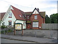
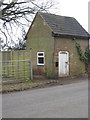
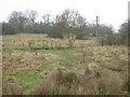
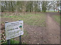


40 photos from this area
Area Information
Key information about the B47 6LZ including its size, population, and administrative classification.
- Area Type
- Postcode
- Area Size
- 12.2 hectares
- Population
- 1631
- Population Density
- 230 people/km²
House Prices in B47 6LZ
47
Properties
£292,931
Average Sold Price
£76,950
Lowest Price
£637,000
Highest Price
Showing 47 properties
| Address | Type | Beds | Baths | Last Sale Price | Last Sale Date | |
|---|---|---|---|---|---|---|
| 88 Silver Street, Wythall, B47 6LZ | house | - | - | £410,000 | May 2025 | |
| 94 Silver Street, Wythall, B47 6LZ | Semi-detached | 3 | 1 | £336,000 | Apr 2024 | |
| 80 Silver Street, Wythall, B47 6LZ | house | - | - | £465,000 | Oct 2023 | |
| 54 Silver Street, Wythall, B47 6LZ | Detached | 3 | 1 | £565,000 | Nov 2022 | |
| 64 Silver Street, Wythall, B47 6LZ | house | 3 | - | £365,000 | Jun 2022 | |
| 52A Silver Street, Wythall, B47 6LZ | Bungalow | - | - | £563,000 | Jan 2022 | |
| 10 Silver Street, Wythall, B47 6LZ | Bungalow | 3 | - | £637,000 | Dec 2021 | |
| 102 Silver Street, Wythall, B47 6LZ | house | 2 | 2 | £450,000 | Jul 2019 | |
| 66 Silver Street, Wythall, B47 6LZ | Semi-detached | 3 | 1 | £280,000 | Oct 2018 | |
| 74 Silver Street, Wythall, B47 6LZ | house | 3 | - | £303,000 | Nov 2017 |
Page 1 of 5
Energy Efficiency in B47 6LZ
Amenities
Schools
| Rank | School | Type | Entry gender | Ages |
|---|
Explore more schools in this area
Go to Schools tabDemographics
Household Size
Two person
most common
Accommodation Type
Houses
most common
Tenure
89
majority
Ethnic Group
White
most common
Religion
N/A
most common
Household Composition
N/A
most common
Age
47
median
Adults (30-64 years)
most common
Household Deprivation
N/A
with no deprivation
NS-SEC
36
in Lower managerial occupations
Explore more demographic insights in this area
Go to Demographics tabPlanning
Planning Constraints
- Flood RiskPremium
- Ramsar Wetland SitesPremium
- Area of Outstanding Natural BeautyPremium
- Protected Nature ReservePremium
- Protected WoodlandPremium