Area Overview for B47 6EP
Photos of B47 6EP
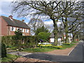


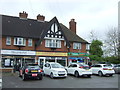
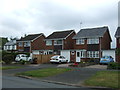
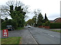
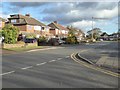
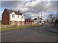
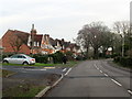
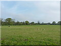
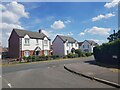
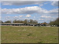
22 photos from this area
Area Information
Key information about the B47 6EP including its size, population, and administrative classification.
- Area Type
- Postcode
- Area Size
- 3.0 hectares
- Population
- 1215
- Population Density
- 221 people/km²
House Prices in B47 6EP
60
Properties
£296,877
Average Sold Price
£86,500
Lowest Price
£525,000
Highest Price
Showing 60 properties
| Address | Type | Beds | Baths | Last Sale Price | Last Sale Date | |
|---|---|---|---|---|---|---|
| 11 Ann Road, Wythall, B47 6EP | Semi-detached | 4 | 1 | £525,000 | Aug 2025 | |
| 52 Ann Road, Wythall, B47 6EP | house | 3 | 1 | £375,000 | Mar 2025 | |
| 21 Ann Road, Wythall, B47 6EP | house | - | - | £350,000 | Feb 2025 | |
| 55 Ann Road, Wythall, B47 6EP | Semi-detached | 3 | 2 | £515,000 | Jun 2024 | |
| 25 Ann Road, Wythall, B47 6EP | Semi-detached | 4 | 1 | £386,000 | Feb 2023 | |
| 17 Ann Road, Wythall, B47 6EP | house | - | - | £386,350 | Oct 2022 | |
| 53 Ann Road, Wythall, B47 6EP | Semi-detached | 3 | 1 | £450,000 | Sep 2022 | |
| 22 Ann Road, Wythall, B47 6EP | Retail | 4 | 2 | £400,000 | Apr 2022 | |
| 58 Ann Road, Wythall, B47 6EP | house | - | - | £352,000 | Feb 2022 | |
| 24 Ann Road, Wythall, B47 6EP | house | - | - | £325,500 | Mar 2021 |
Page 1 of 6
Energy Efficiency in B47 6EP
Amenities
Schools
| Rank | School | Type | Entry gender | Ages |
|---|
Explore more schools in this area
Go to Schools tabDemographics
Household Size
Two person
most common
Accommodation Type
Houses
most common
Tenure
95
majority
Ethnic Group
White
most common
Religion
N/A
most common
Household Composition
N/A
most common
Age
47
median
Adults (30-64 years)
most common
Household Deprivation
N/A
with no deprivation
NS-SEC
41
in Lower managerial occupations
Explore more demographic insights in this area
Go to Demographics tabPlanning
Planning Constraints
- Flood RiskPremium
- Ramsar Wetland SitesPremium
- Area of Outstanding Natural BeautyPremium
- Protected Nature ReservePremium
- Protected WoodlandPremium