Area Overview for B46 3LD
Photos of B46 3LD

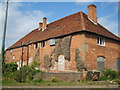
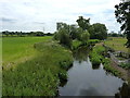
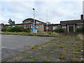


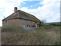

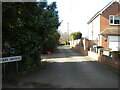
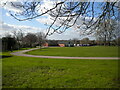
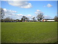
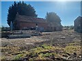
28 photos from this area
Area Information
Key information about the B46 3LD including its size, population, and administrative classification.
- Area Type
- Postcode
- Area Size
- 2.3 hectares
- Population
- 1795
- Population Density
- 1549 people/km²
House Prices in B46 3LD
52
Properties
£194,390
Average Sold Price
£75,000
Lowest Price
£350,000
Highest Price
Showing 52 properties
| Address | Type | Beds | Baths | Last Sale Price | Last Sale Date | |
|---|---|---|---|---|---|---|
| 89 Parkfield Road, Coleshill, B46 3LD | Flat | 2 | 1 | £255,000 | Nov 2024 | |
| 55 Parkfield Road, Coleshill, B46 3LD | Semi-detached | 3 | 1 | £235,000 | Dec 2023 | |
| 91 Parkfield Road, Coleshill, B46 3LD | Flat | - | - | £147,000 | Aug 2023 | |
| 87 Parkfield Road, Coleshill, B46 3LD | Flat | - | - | £170,000 | Mar 2023 | |
| 63 Parkfield Road, Coleshill, B46 3LD | Terraced | 3 | 1 | £235,000 | Sep 2022 | |
| 2, Parkfield House, Parkfield Road, Coleshill, B46 3LD | Maisonette | - | - | £230,000 | Sep 2022 | |
| 47 Parkfield Road, Coleshill, B46 3LD | house | - | - | £240,000 | Mar 2022 | |
| 33 Parkfield Road, Coleshill, B46 3LD | Semi-detached | 3 | 1 | £270,000 | Nov 2021 | |
| 65 Parkfield Road, Coleshill, B46 3LD | Terraced | 3 | - | £218,000 | Sep 2021 | |
| 69 Parkfield Road, Coleshill, B46 3LD | Terraced | 3 | 1 | £180,000 | Jan 2021 |
Page 1 of 6
Energy Efficiency in B46 3LD
Amenities
Schools
| Rank | School | Type | Entry gender | Ages |
|---|
Explore more schools in this area
Go to Schools tabDemographics
Household Size
One person
most common
Accommodation Type
Houses
most common
Tenure
60
majority
Ethnic Group
White
most common
Religion
N/A
most common
Household Composition
N/A
most common
Age
47
median
Adults (30-64 years)
most common
Household Deprivation
N/A
with no deprivation
NS-SEC
31
in Lower managerial occupations
Explore more demographic insights in this area
Go to Demographics tabPlanning
Planning Constraints
- Flood RiskPremium
- Ramsar Wetland SitesPremium
- Area of Outstanding Natural BeautyPremium
- Protected Nature ReservePremium
- Protected WoodlandPremium