Area Overview for B46 3AB
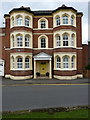
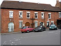
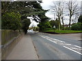
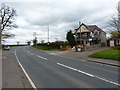
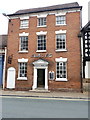
Photos of B46 3AB

Area Information
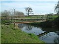
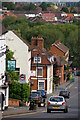
Living in B46 3AB means being part of a tightly knit residential cluster in Warwickshire, where the population of 1,795 is spread across a compact area with a density of 1,549 people per square kilometre. This postcode sits in Coleshill, a historic town with roots in the Iron Age and a legacy of Roman and medieval influence. The area’s character is defined by its mix of traditional housing and modern amenities, with a strong sense of community centred around local institutions. Daily life here is shaped by proximity to schools, retail, and transport links, making it practical for families and commuters. The median age of 47 suggests a mature population, with many residents in their prime working years. While the area lacks large-scale developments, its small size fosters a close-knit environment where neighbours are likely to know one another. For those seeking a balance between historical charm and contemporary convenience, B46 3AB offers a distinct blend of heritage and accessibility.
- Area Type
- Postcode
- Area Size
- Not available
- Population
- 1795
- Population Density
- 1549 people/km²
The property market in B46 3AB is characterised by a high rate of home ownership (60%) and a predominance of houses over flats or apartments. This suggests a mix of owner-occupied properties and rental units, though the exact split between the two is not specified. The concentration of houses may reflect the area’s historical development and lower population density. For buyers, this means a focus on single-family homes rather than high-rise or shared accommodation. The small size of the postcode area implies limited housing stock, which could lead to competition among buyers. Proximity to transport links and schools may also drive demand, particularly for families. However, the lack of large-scale development means property values are likely to be influenced more by location-specific factors than broader market trends.
House Prices in B46 3AB
No properties found in this postcode.
Energy Efficiency in B46 3AB
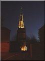
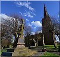
Residents of B46 3AB enjoy a range of amenities within practical reach, including five retail outlets such as Morrisons Coleshill and Aldi Station. The area’s proximity to Coleshill Parkway Railway Station and Birmingham International Airport enhances its convenience for both daily commuting and travel. While parks and leisure facilities are not explicitly listed, the town’s historical sites, such as St Peter’s Church and the High Street sculpture, contribute to a culturally rich environment. The presence of multiple retail and transport hubs supports a lifestyle that balances practicality with access to local heritage. For families, the combination of schools, shops, and transport links creates a self-contained community where daily needs can be met without extensive travel.
Amenities
Schools
Residents of B46 3AB have access to three primary schools: Coleshill CofE Primary School, Coleshill CofE First School, and Coleshill Church of England Primary School, which holds a ‘good’ Ofsted rating. These schools provide a range of options for families, with the latter’s rating indicating a standard of education that meets or exceeds national benchmarks. The presence of multiple primary schools within the area reduces the need for long commutes and supports a community-focused approach to education. While no secondary schools are listed, the proximity to nearby towns may offer additional options. The concentration of primary schools suggests a family-friendly environment, with local infrastructure designed to accommodate the needs of children and parents.
| Rank | School | Type | Entry gender | Ages |
|---|
Explore more schools in this area
Go to Schools tabDemographics
The community in B46 3AB is predominantly composed of adults aged 30–64, with a median age of 47. This suggests a population largely in their peak working years, which may influence local services and employment patterns. Home ownership is high at 60%, indicating a stable residential base with many long-term residents. The accommodation type is primarily houses, which aligns with the area’s lower density and traditional layout. The predominant ethnic group is White, reflecting the broader demographic trends in rural Warwickshire. While specific data on deprivation is not provided, the high home ownership rate and presence of essential amenities suggest a relatively stable quality of life. The age profile and ownership figures indicate a community that is both established and family-oriented, with fewer transient residents compared to urban areas.
Household Size
Accommodation Type
Tenure
Ethnic Group
Religion
Household Composition
Age
Household Deprivation
NS-SEC
Explore more demographic insights in this area
Go to Demographics tabPlanning
Planning Constraints
- Flood RiskPremium
- Ramsar Wetland SitesPremium
- Area of Outstanding Natural BeautyPremium
- Protected Nature ReservePremium
- Protected WoodlandPremium