Area Overview for B46 2LG
Photos of B46 2LG
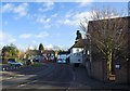
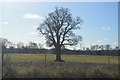

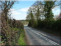
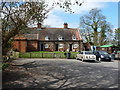


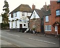
14 photos from this area
Area Information
Key information about the B46 2LG including its size, population, and administrative classification.
- Area Type
- Postcode
- Area Size
- 20.6 hectares
- Population
- 1281
- Population Density
- 98 people/km²
House Prices in B46 2LG
16
Properties
£261,000
Average Sold Price
£72,000
Lowest Price
£495,000
Highest Price
Showing 16 properties
| Address | Type | Beds | Baths | Last Sale Price | Last Sale Date | |
|---|---|---|---|---|---|---|
| The Old Post Office, Coleshill Road, Furnace End, B46 2LG | Detached | 5 | 2 | £360,000 | Jan 2025 | |
| 2, Cheshire Cottages, Coleshill Road, Furnace End, B46 2LG | Terraced | 2 | 1 | £195,000 | Oct 2024 | |
| Stubways, Coleshill Road, Furnace End, B46 2LG | Terraced | 2 | 1 | £183,000 | Apr 2022 | |
| Mill Farmhouse, Coleshill Road, Furnace End, B46 2LG | Semi-detached | - | - | £495,000 | Dec 2005 | |
| Wayside Cottage, Coleshill Road, Furnace End, B46 2LG | Terraced | 2 | 1 | £72,000 | Mar 2001 | |
| Gleaners, Mill Bank, Coleshill Road, Furnace End, B46 2LG | Terraced | 3 | 1 | - | - | |
| Threshings, Mill Bank, Coleshill Road, Furnace End, B46 2LG | Terraced | 3 | 2 | - | - | |
| Mill Cottage, Coleshill Road, Furnace End, B46 2LG | Cottage | 3 | 1 | - | - | |
| Kingfishers, Coleshill Road, Furnace End, B46 2LG | Detached | - | - | - | - | |
| 2, Claremont Villas, Coleshill Road, Furnace End, B46 2LG | house | - | - | - | - |
Page 1 of 2
Energy Efficiency in B46 2LG
Amenities
Schools
| Rank | School | Type | Entry gender | Ages |
|---|
Explore more schools in this area
Go to Schools tabDemographics
Household Size
Two person
most common
Accommodation Type
Houses
most common
Tenure
86
majority
Ethnic Group
White
most common
Religion
N/A
most common
Household Composition
N/A
most common
Age
47
median
Adults (30-64 years)
most common
Household Deprivation
N/A
with no deprivation
NS-SEC
37
in Lower managerial occupations
Explore more demographic insights in this area
Go to Demographics tabPlanning
Planning Constraints
- Flood RiskPremium
- Ramsar Wetland SitesPremium
- Area of Outstanding Natural BeautyPremium
- Protected Nature ReservePremium
- Protected WoodlandPremium