Area Overview for B46 2EH
Photos of B46 2EH
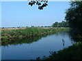
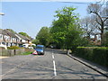
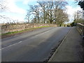
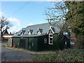
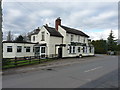


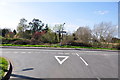
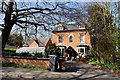
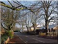
15 photos from this area
Area Information
Key information about the B46 2EH including its size, population, and administrative classification.
- Area Type
- Postcode
- Area Size
- 15.8 hectares
- Population
- 1799
- Population Density
- 62 people/km²
House Prices in B46 2EH
25
Properties
£301,469
Average Sold Price
£57,000
Lowest Price
£720,000
Highest Price
Showing 25 properties
| Address | Type | Beds | Baths | Last Sale Price | Last Sale Date | |
|---|---|---|---|---|---|---|
| 28 Station Road, Whitacre Heath, B46 2EH | Detached | 4 | 2 | £557,500 | Jul 2025 | |
| 48 Station Road, Whitacre Heath, B46 2EH | Semi-detached | 3 | 1 | £492,500 | May 2024 | |
| Dreycote, 34 Station Road, Whitacre Heath, B46 2EH | Detached | 5 | - | £720,000 | Dec 2023 | |
| 4 Station Road, Whitacre Heath, B46 2EH | Bungalow | 3 | 1 | £485,000 | Jan 2022 | |
| Burbury Cottage, 54 Station Road, Whitacre Heath, B46 2EH | Detached | 2 | 1 | £308,000 | Jun 2021 | |
| Woodbine, 50 Station Road, Whitacre Heath, B46 2EH | house | - | - | £240,000 | Feb 2020 | |
| 8 Station Road, Whitacre Heath, B46 2EH | Detached | 5 | 1 | £320,000 | Feb 2019 | |
| Wayside, 16 Station Road, Whitacre Heath, B46 2EH | Semi-detached | 3 | 1 | £275,000 | Jul 2017 | |
| 20 Station Road, Whitacre Heath, B46 2EH | Detached | 4 | - | £260,000 | Mar 2017 | |
| The Bower, 32A Station Road, Whitacre Heath, B46 2EH | Bungalow | 2 | 1 | £249,995 | Mar 2014 |
Page 1 of 3
Energy Efficiency in B46 2EH
Amenities
Schools
| Rank | School | Type | Entry gender | Ages |
|---|
Explore more schools in this area
Go to Schools tabDemographics
Household Size
Two person
most common
Accommodation Type
Houses
most common
Tenure
83
majority
Ethnic Group
White
most common
Religion
N/A
most common
Household Composition
N/A
most common
Age
47
median
Adults (30-64 years)
most common
Household Deprivation
N/A
with no deprivation
NS-SEC
39
in Lower managerial occupations
Explore more demographic insights in this area
Go to Demographics tabPlanning
Planning Constraints
- Flood RiskPremium
- Ramsar Wetland SitesPremium
- Area of Outstanding Natural BeautyPremium
- Protected Nature ReservePremium
- Protected WoodlandPremium