Area Overview for B46 2BW
Photos of B46 2BW

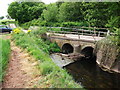
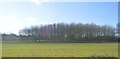

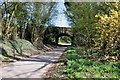
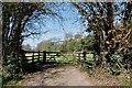
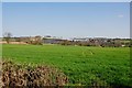
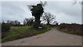
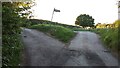
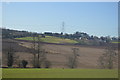
10 photos from this area
Area Information
Key information about the B46 2BW including its size, population, and administrative classification.
- Area Type
- Postcode
- Area Size
- 23.2 hectares
- Population
- 1902
- Population Density
- 39 people/km²
House Prices in B46 2BW
14
Properties
£557,857
Average Sold Price
£130,000
Lowest Price
£750,000
Highest Price
Showing 14 properties
| Address | Type | Beds | Baths | Last Sale Price | Last Sale Date | |
|---|---|---|---|---|---|---|
| Wood Sorrel House, 7 Malkins Way, Shustoke, B46 2BW | Semi-detached | 3 | 2 | £500,000 | Aug 2024 | |
| Charlock House, 3 Malkins Way, Shustoke, B46 2BW | house | - | - | £750,000 | Oct 2021 | |
| Calluna House, 4 Malkins Way, Shustoke, B46 2BW | house | - | - | £710,000 | Feb 2021 | |
| The Bilberry, 10 Malkins Way, Shustoke, B46 2BW | house | - | - | £600,000 | Feb 2021 | |
| Capsella House, 2 Malkins Way, Shustoke, B46 2BW | Semi-detached | 5 | 2 | £695,000 | Oct 2020 | |
| Honeysuckle, 1 Malkins Way, Shustoke, B46 2BW | Detached | 5 | 2 | £130,000 | Jun 2020 | |
| Wild Cherry Cottage, 9 Malkins Way, Shustoke, B46 2BW | Semi-detached | 3 | 2 | £520,000 | Jul 2018 | |
| Pennycress House, 6 Malkins Way, Shustoke, B46 2BW | Semi-detached | 3 | 2 | - | - | |
| Rosebay Cottage, 8 Malkins Way, Shustoke, B46 2BW | Retail | 4 | 2 | - | - | |
| The Heathers, 11 Malkins Way, Shustoke, B46 2BW | house | 5 | 4 | - | - |
Page 1 of 2
Energy Efficiency in B46 2BW
Amenities
Schools
| Rank | School | Type | Entry gender | Ages |
|---|
Explore more schools in this area
Go to Schools tabDemographics
Household Size
Two person
most common
Accommodation Type
Houses
most common
Tenure
69
majority
Ethnic Group
White
most common
Religion
N/A
most common
Household Composition
N/A
most common
Age
47
median
Adults (30-64 years)
most common
Household Deprivation
N/A
with no deprivation
NS-SEC
40
in Lower managerial occupations
Explore more demographic insights in this area
Go to Demographics tabPlanning
Planning Constraints
- Flood RiskPremium
- Ramsar Wetland SitesPremium
- Area of Outstanding Natural BeautyPremium
- Protected Nature ReservePremium
- Protected WoodlandPremium