Area Overview for B46 2AD
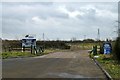
Photos of B46 2AD
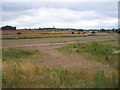


Area Information
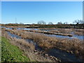
Living in B46 2AD offers a quiet, low-density residential experience, with a population of 1,902 spread across a small cluster of homes. The area’s sparse population density of 39 people per square kilometre suggests a relaxed, community-focused lifestyle, far removed from the bustle of larger cities. This postcode is positioned near key amenities, including schools, rail networks, and retail hubs, making it practical for families and commuters. The median age of 47 and a dominant age range of 30–64 years indicate a stable, established population, with many residents likely to be homeowners. Daily life here balances suburban tranquillity with access to essential services, such as nearby primary schools and railway stations. The absence of significant environmental constraints or flood risks adds to its appeal, though standard security measures are advisable due to a medium crime risk. For those seeking a peaceful yet connected home, B46 2AD provides a blend of practicality and comfort.
- Area Type
- Postcode
- Area Size
- Not available
- Population
- 1902
- Population Density
- 39 people/km²
B46 2AD is primarily an owner-occupied area, with 69% of homes owned by residents rather than rented. The accommodation type is predominantly houses, which is typical of smaller, low-density residential clusters. This suggests a market where properties are likely to be family homes rather than investment properties or apartments. The limited size of the area means the housing stock is constrained, and buyers may need to consider nearby regions for more options. The high home ownership rate implies a stable market, but competition for available properties could be fierce. For those seeking a home in this postcode, the focus should be on houses, with potential for long-term value retention. The absence of large-scale developments or rental-focused schemes reinforces the area’s character as a quiet, residential hub.
House Prices in B46 2AD
No properties found in this postcode.
Energy Efficiency in B46 2AD
Residents of B46 2AD benefit from nearby amenities that support both daily convenience and leisure. Retail options include Aldi Station, Morrisons Coleshill, and Tesco Water, providing access to groceries and essentials. The area’s rail network connects to broader regional services, while proximity to Birmingham International Airport adds to its transport versatility. Though the low population density suggests a quieter lifestyle, the practical reach of amenities ensures residents are not isolated. The mix of retail, transport, and nearby schools creates a self-contained environment, ideal for families seeking a balance between suburban calm and accessible services. The absence of large-scale leisure facilities means residents may need to travel slightly further for entertainment, but the area’s strategic location mitigates this limitation.
Amenities
Schools
Residents of B46 2AD have access to a range of primary schools, including Fillongley CofE First School, Shustoke CofE Primary School, and Bournebrook CofE Primary School, all of which hold Ofsted ratings of ‘good’. The THE SECRET GARDEN SCHOOL, an independent institution, also operates in the area with a ‘good’ rating, offering an alternative to state education. Mill House School, a special needs school, provides tailored education with the same ‘good’ rating. This mix of state, independent, and specialist schools caters to diverse family needs, from mainstream education to specific learning requirements. The proximity of multiple schools within practical reach ensures that families have options for their children’s schooling, whether they seek a traditional state school or an independent setting.
| Rank | School | Type | Entry gender | Ages |
|---|
Explore more schools in this area
Go to Schools tabDemographics
The community in B46 2AD is predominantly composed of adults aged 30–64 years, with a median age of 47. This suggests a mature, stable population, likely with established careers and family ties. Home ownership is high at 69%, indicating a strong presence of long-term residents and a lower proportion of rental properties. The area is characterised by houses rather than flats or apartments, reflecting a suburban or semi-rural housing stock. The predominant ethnic group is White, though specific data on diversity is not provided. With no mention of deprivation levels, the area appears to support a quality of life aligned with its demographic profile. The combination of homeownership, age distribution, and housing type points to a community that values stability and family-oriented living.
Household Size
Accommodation Type
Tenure
Ethnic Group
Religion
Household Composition
Age
Household Deprivation
NS-SEC
Explore more demographic insights in this area
Go to Demographics tabPlanning
Planning Constraints
- Flood RiskPremium
- Ramsar Wetland SitesPremium
- Area of Outstanding Natural BeautyPremium
- Protected Nature ReservePremium
- Protected WoodlandPremium