Area Overview for B46 1RS
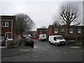
Photos of B46 1RS


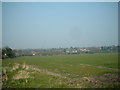
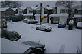

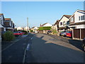
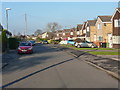


Area Information
Living in B46 1RS means being part of a tightly knit residential cluster in England, home to 1,634 people spread across a compact area. With a population density of 1,428 people per square kilometre, this postcode reflects a community that values proximity and local connections. The area is defined by its modest scale, where daily life revolves around nearby amenities and a stable demographic profile. Residents here are predominantly adults aged 30–64, with a median age of 47, suggesting a mature, settled population. The high home ownership rate of 80% indicates a strong sense of permanence, with most properties being houses rather than flats. While the area lacks major urban landmarks, its appeal lies in its practicality: low crime risk, reliable digital connectivity, and access to essential services. For buyers seeking a quiet, family-friendly environment without the pressures of a bustling city, B46 1RS offers a balance of safety, convenience, and community cohesion.
- Area Type
- Postcode
- Area Size
- Not available
- Population
- 1634
- Population Density
- 1428 people/km²
The property market in B46 1RS is characterised by a high rate of home ownership, with 80% of residents owning their homes. This suggests a stable, long-term population with a preference for private ownership over rental living. The accommodation type is predominantly houses, which is unusual for areas with higher population densities, indicating a mix of larger properties and possibly some newer developments. Given the small size of the postcode, the housing stock is likely limited in variety, with buyers needing to consider nearby areas for alternative options. The high home ownership rate also implies that the area may have a lower turnover of properties, making it a good choice for those seeking a settled, community-focused environment. However, the limited data on property types or price ranges means buyers should explore adjacent postcodes for a fuller picture of the market.
House Prices in B46 1RS
No properties found in this postcode.
Energy Efficiency in B46 1RS
The lifestyle in B46 1RS is supported by a range of nearby amenities, including five retail outlets such as Tesco Water, Heron Smith, and Spar, ensuring everyday shopping needs are met. The area’s proximity to five railway stations, including Water Orton Railway Station and Lea Hall Railway Station, offers convenient travel options for commuting or leisure. Nearby, Birmingham International Airport and Birmingham Intl Railway Station provide additional connectivity for regional and national travel. While the area lacks detailed information on parks or leisure facilities, the combination of retail, rail, and air links suggests a practical, service-oriented lifestyle. Residents can enjoy a balance of local convenience and broader access to urban amenities.
Amenities
Schools
Residents of B46 1RS have access to three primary schools within practical reach: Water Orton Primary School, Water Orton First School, and Water Orton Middle School. Two of these schools have an Ofsted rating of ‘satisfactory’, while the third lacks a specified rating. The presence of multiple primary schools suggests a focus on early education, though the absence of secondary schools nearby may require families to look further afield for secondary education. This mix of school types could be beneficial for younger children, offering options for different teaching approaches or proximity to specific needs. However, the lack of detailed performance data means prospective buyers should investigate further to assess the quality of education available to their children.
| Rank | School | Type | Entry gender | Ages |
|---|
Explore more schools in this area
Go to Schools tabDemographics
The community in B46 1RS is predominantly composed of adults aged 30–64, with a median age of 47. This suggests a population that is largely established, with fewer young families or retirees compared to other areas. Home ownership is high, with 80% of residents owning their homes, and the majority of properties are houses rather than flats. The predominant ethnic group is White, reflecting a relatively homogenous demographic profile. While no specific data on deprivation or diversity is provided, the high home ownership rate and stable age distribution imply a community with a strong economic foundation. This demographic structure likely supports a steady demand for local services and amenities, as residents are likely to be long-term residents with established routines and needs.
Household Size
Accommodation Type
Tenure
Ethnic Group
Religion
Household Composition
Age
Household Deprivation
NS-SEC
Explore more demographic insights in this area
Go to Demographics tabPlanning
Planning Constraints
- Flood RiskPremium
- Ramsar Wetland SitesPremium
- Area of Outstanding Natural BeautyPremium
- Protected Nature ReservePremium
- Protected WoodlandPremium