Area Overview for B46 1NH
Photos of B46 1NH
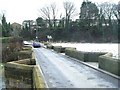
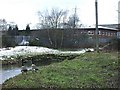
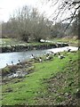
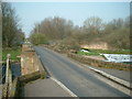
50 photos from this area
Area Information
Key information about the B46 1NH including its size, population, and administrative classification.
- Area Type
- Postcode
- Area Size
- 25.5 hectares
- Population
- 1476
- Population Density
- 283 people/km²
House Prices in B46 1NH
16
Properties
£254,161
Average Sold Price
£77,500
Lowest Price
£510,000
Highest Price
Showing 16 properties
| Address | Type | Beds | Baths | Last Sale Price | Last Sale Date | |
|---|---|---|---|---|---|---|
| 52 Minworth Road, Water Orton, B46 1NH | Detached | 3 | 1 | £399,950 | Apr 2020 | |
| 54 Minworth Road, Water Orton, B46 1NH | Semi-detached | 2 | 1 | £240,000 | Oct 2018 | |
| 3 Minworth Road, Water Orton, B46 1NH | Detached | 2 | 1 | £510,000 | Aug 2017 | |
| 2 Minworth Road, Water Orton, B46 1NH | Terraced | 2 | 1 | £190,000 | May 2017 | |
| 8 Minworth Road, Water Orton, B46 1NH | house | 2 | - | £150,000 | Apr 2016 | |
| 56 Minworth Road, Water Orton, B46 1NH | Semi-detached | 2 | - | £250,000 | Jan 2016 | |
| 10 Minworth Road, Water Orton, B46 1NH | Terraced | 2 | 1 | £160,000 | Sep 2015 | |
| 42 Minworth Road, Water Orton, B46 1NH | Detached | - | - | £310,000 | Nov 2012 | |
| 4 Minworth Road, Water Orton, B46 1NH | Terraced | - | - | £77,500 | Apr 2001 | |
| 12 Minworth Road, Water Orton, B46 1NH | Terraced | 2 | 1 | - | - |
Page 1 of 2
Energy Efficiency in B46 1NH
Amenities
Schools
| Rank | School | Type | Entry gender | Ages |
|---|
Explore more schools in this area
Go to Schools tabDemographics
Household Size
Two person
most common
Accommodation Type
Houses
most common
Tenure
64
majority
Ethnic Group
White
most common
Religion
N/A
most common
Household Composition
N/A
most common
Age
47
median
Adults (30-64 years)
most common
Household Deprivation
N/A
with no deprivation
NS-SEC
25
in Lower managerial occupations
Explore more demographic insights in this area
Go to Demographics tabPlanning
Planning Constraints
- Flood RiskPremium
- Ramsar Wetland SitesPremium
- Area of Outstanding Natural BeautyPremium
- Protected Nature ReservePremium
- Protected WoodlandPremium