Area Overview for B46 1ET
Photos of B46 1ET

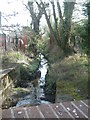
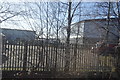
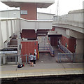
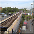

34 photos from this area
Area Information
Key information about the B46 1ET including its size, population, and administrative classification.
- Area Type
- Postcode
- Area Size
- 1.2 hectares
- Population
- 1717
- Population Density
- 380 people/km²
House Prices in B46 1ET
38
Properties
£208,519
Average Sold Price
£50,000
Lowest Price
£320,000
Highest Price
Showing 38 properties
| Address | Type | Beds | Baths | Last Sale Price | Last Sale Date | |
|---|---|---|---|---|---|---|
| 74 Norton Road, Coleshill, B46 1ET | house | - | - | £280,000 | Apr 2025 | |
| 52 Norton Road, Coleshill, B46 1ET | house | 3 | 1 | £320,000 | Oct 2022 | |
| 22 Norton Road, Coleshill, B46 1ET | Semi-detached | 3 | 1 | £285,000 | May 2022 | |
| 28 Norton Road, Coleshill, B46 1ET | house | - | - | £280,000 | Mar 2022 | |
| 44 Norton Road, Coleshill, B46 1ET | Terraced | 3 | 1 | £190,000 | Feb 2021 | |
| 20 Norton Road, Coleshill, B46 1ET | Semi-detached | 3 | 1 | £227,900 | Jan 2020 | |
| 24 Norton Road, Coleshill, B46 1ET | Semi-detached | 3 | 1 | £265,500 | Apr 2019 | |
| 56 Norton Road, Coleshill, B46 1ET | Semi-detached | 5 | 2 | £274,000 | Feb 2018 | |
| 68 Norton Road, Coleshill, B46 1ET | Semi-detached | 3 | 1 | £236,500 | Nov 2017 | |
| 4 Norton Road, Coleshill, B46 1ET | Semi-detached | 3 | 1 | £238,000 | Aug 2017 |
Page 1 of 4
Energy Efficiency in B46 1ET
Amenities
Schools
| Rank | School | Type | Entry gender | Ages |
|---|
Explore more schools in this area
Go to Schools tabDemographics
Household Size
Family (3-5 people)
most common
Accommodation Type
Houses
most common
Tenure
79
majority
Ethnic Group
White
most common
Religion
N/A
most common
Household Composition
N/A
most common
Age
47
median
Adults (30-64 years)
most common
Household Deprivation
N/A
with no deprivation
NS-SEC
34
in Lower managerial occupations
Explore more demographic insights in this area
Go to Demographics tabPlanning
Planning Constraints
- Flood RiskPremium
- Ramsar Wetland SitesPremium
- Area of Outstanding Natural BeautyPremium
- Protected Nature ReservePremium
- Protected WoodlandPremium