Area Overview for B46 1EQ
Photos of B46 1EQ
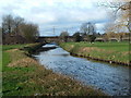
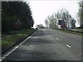

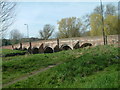
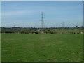
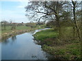

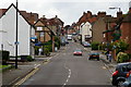
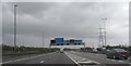
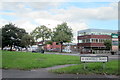
63 photos from this area
Area Information
Key information about the B46 1EQ including its size, population, and administrative classification.
- Area Type
- Postcode
- Area Size
- 1.3 hectares
- Population
- 1517
- Population Density
- 777 people/km²
House Prices in B46 1EQ
18
Properties
£196,381
Average Sold Price
£66,000
Lowest Price
£300,000
Highest Price
Showing 18 properties
| Address | Type | Beds | Baths | Last Sale Price | Last Sale Date | |
|---|---|---|---|---|---|---|
| 66 Lichfield Road, Coleshill, B46 1EQ | Semi-detached | - | - | £265,000 | Sep 2023 | |
| 62 Lichfield Road, Coleshill, B46 1EQ | house | - | - | £250,000 | Aug 2022 | |
| 82 Lichfield Road, Coleshill, B46 1EQ | Semi-detached | 3 | 1 | £263,100 | Dec 2021 | |
| 54 Lichfield Road, Coleshill, B46 1EQ | Semi-detached | 4 | 2 | £300,000 | Jun 2021 | |
| 84 Lichfield Road, Coleshill, B46 1EQ | Semi-detached | 3 | 1 | £195,000 | Jul 2018 | |
| 74 Lichfield Road, Coleshill, B46 1EQ | Detached | 4 | 2 | £145,000 | Sep 2004 | |
| 76 Lichfield Road, Coleshill, B46 1EQ | Semi-detached | - | - | £86,950 | Feb 2000 | |
| 64 Lichfield Road, Coleshill, B46 1EQ | Semi-detached | - | - | £66,000 | Dec 1998 | |
| 72 Lichfield Road, Coleshill, B46 1EQ | Semi-detached | - | - | - | - | |
| 78 Lichfield Road, Coleshill, B46 1EQ | Semi-detached | - | - | - | - |
Page 1 of 2
Energy Efficiency in B46 1EQ
Amenities
Schools
| Rank | School | Type | Entry gender | Ages |
|---|
Explore more schools in this area
Go to Schools tabDemographics
Household Size
Two person
most common
Accommodation Type
Houses
most common
Tenure
76
majority
Ethnic Group
White
most common
Religion
N/A
most common
Household Composition
N/A
most common
Age
47
median
Adults (30-64 years)
most common
Household Deprivation
N/A
with no deprivation
NS-SEC
33
in Lower managerial occupations
Explore more demographic insights in this area
Go to Demographics tabPlanning
Planning Constraints
- Flood RiskPremium
- Ramsar Wetland SitesPremium
- Area of Outstanding Natural BeautyPremium
- Protected Nature ReservePremium
- Protected WoodlandPremium