Area Overview for B46 1AY
Photos of B46 1AY
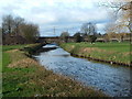

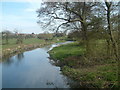

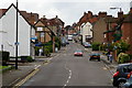
63 photos from this area
Area Information
Key information about the B46 1AY including its size, population, and administrative classification.
- Area Type
- Postcode
- Area Size
- 5531 m²
- Population
- 1795
- Population Density
- 1549 people/km²
House Prices in B46 1AY
22
Properties
£123,806
Average Sold Price
£59,995
Lowest Price
£205,000
Highest Price
Showing 22 properties
| Address | Type | Beds | Baths | Last Sale Price | Last Sale Date | |
|---|---|---|---|---|---|---|
| 47 High Street, Coleshill, B46 1AY | Terraced | 3 | 1 | £205,000 | Jul 2018 | |
| 53 High Street, Coleshill, B46 1AY | Terraced | 3 | - | £144,500 | Oct 2017 | |
| 51 High Street, Coleshill, B46 1AY | house | - | - | £170,000 | Dec 2015 | |
| 57 High Street, Coleshill, B46 1AY | house | - | - | £162,000 | Aug 2004 | |
| 15 High Street, Coleshill, B46 1AY | Terraced | 3 | - | £86,000 | Jun 2003 | |
| 55 High Street, Coleshill, B46 1AY | Terraced | 3 | 1 | £84,950 | Sep 2001 | |
| 49 High Street, Coleshill, B46 1AY | Terraced | - | - | £78,000 | Apr 2000 | |
| 45 High Street, Coleshill, B46 1AY | Terraced | - | - | £59,995 | Feb 1996 | |
| 17 High Street, Coleshill, B46 1AY | Semi-detached | - | - | - | - | |
| 21 High Street, Coleshill, B46 1AY | Flat | - | - | - | - |
Page 1 of 3
Energy Efficiency in B46 1AY
Amenities
Schools
| Rank | School | Type | Entry gender | Ages |
|---|
Explore more schools in this area
Go to Schools tabDemographics
Household Size
One person
most common
Accommodation Type
Houses
most common
Tenure
60
majority
Ethnic Group
White
most common
Religion
N/A
most common
Household Composition
N/A
most common
Age
47
median
Adults (30-64 years)
most common
Household Deprivation
N/A
with no deprivation
NS-SEC
31
in Lower managerial occupations
Explore more demographic insights in this area
Go to Demographics tabPlanning
Planning Constraints
- Flood RiskPremium
- Ramsar Wetland SitesPremium
- Area of Outstanding Natural BeautyPremium
- Protected Nature ReservePremium
- Protected WoodlandPremium