Area Overview for B46 1AN
Photos of B46 1AN
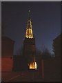
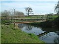

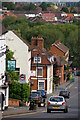
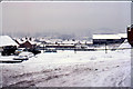
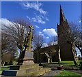

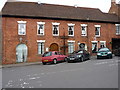
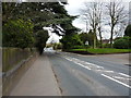
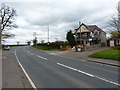

52 photos from this area
Area Information
Key information about the B46 1AN including its size, population, and administrative classification.
- Area Type
- Postcode
- Area Size
- 4.9 hectares
- Population
- 1795
- Population Density
- 1549 people/km²
House Prices in B46 1AN
23
Properties
£376,663
Average Sold Price
£214,800
Lowest Price
£534,950
Highest Price
Showing 23 properties
| Address | Type | Beds | Baths | Last Sale Price | Last Sale Date | |
|---|---|---|---|---|---|---|
| 22 Macfarlane Way, Coleshill, B46 1AN | house | - | - | £369,000 | Dec 2024 | |
| 11 Macfarlane Way, Coleshill, B46 1AN | Semi-detached | 2 | 1 | £256,000 | Jun 2024 | |
| 20 Macfarlane Way, Coleshill, B46 1AN | Semi-detached | 3 | 2 | £370,000 | Dec 2023 | |
| 21 Macfarlane Way, Coleshill, B46 1AN | Semi-detached | 4 | 2 | £415,000 | Aug 2023 | |
| 18 Macfarlane Way, Coleshill, B46 1AN | Retail | 4 | 1 | £408,000 | Sep 2022 | |
| 10 Macfarlane Way, Coleshill, B46 1AN | house | - | - | £370,000 | Jul 2020 | |
| 12 Macfarlane Way, Coleshill, B46 1AN | Terraced | 4 | 2 | £373,250 | Jul 2020 | |
| 16 Macfarlane Way, Coleshill, B46 1AN | house | - | - | £375,950 | Jun 2020 | |
| 19 Macfarlane Way, Coleshill, B46 1AN | house | - | - | £395,950 | Jan 2020 | |
| 14 Macfarlane Way, Coleshill, B46 1AN | Terraced | 4 | 2 | £385,000 | Oct 2019 |
Page 1 of 3
Energy Efficiency in B46 1AN
Amenities
Schools
| Rank | School | Type | Entry gender | Ages |
|---|
Explore more schools in this area
Go to Schools tabDemographics
Household Size
One person
most common
Accommodation Type
Houses
most common
Tenure
60
majority
Ethnic Group
White
most common
Religion
N/A
most common
Household Composition
N/A
most common
Age
47
median
Adults (30-64 years)
most common
Household Deprivation
N/A
with no deprivation
NS-SEC
31
in Lower managerial occupations
Explore more demographic insights in this area
Go to Demographics tabPlanning
Planning Constraints
- Flood RiskPremium
- Ramsar Wetland SitesPremium
- Area of Outstanding Natural BeautyPremium
- Protected Nature ReservePremium
- Protected WoodlandPremium